













The Battle of Little Bighorn: Custer's Last Stand, June 25th 1876
Authentic artwork
The artwork we print is faithfully restored from the original source - usually a museum, auction house or private collection.
We never replace, redraw or invent the artist’s work using generative AI.
Restored in our London workshop from the original 1876 artwork and printed to museum-grade archival standards. Full description
The Collector’s Offer
Choose two eligible works and receive 20% off both. Choose three and the lowest-priced one is complimentary, a maximum saving of 33%.
Mix and match eligible standard maps and fine-art prints. No code is required; the offer is applied automatically at checkout.
Standard made-to-order configurations are included. Bespoke sizes, personalised designs and commissioned work are excluded.
Need delivery to different addresses? Contact us before ordering.The Collector’s Offer
Choose two eligible works and receive 20% off both. Choose three and the lowest-priced one is complimentary, a maximum saving of 33%.
Mix and match eligible standard maps and fine-art prints. No code is required; the offer is applied automatically at checkout.
Standard made-to-order configurations are included. Bespoke sizes, personalised designs and commissioned work are excluded.
Need delivery to different addresses? Contact us before ordering. Restored in London • Printed and framed in the USA
Authentic artwork
The artwork we print is faithfully restored from the original source - usually a museum, auction house or private collection.
We never replace, redraw or invent the artist’s work using generative AI.
Restored from the original 1876 artwork and printed to museum-grade archival standards. Full description
Choose your size
Choose your finish


(More info)
Gift message & custom finish

If you want to add a gift message, or a finish (jigsaw, aluminium board, etc.) that is not available here, please request it in the "order note" when you check out.
Every order is custom made, so if you need the size adjusted slightly, or printed on an unusual material, just let us know. We've done thousands of custom orders over the years, so there's (almost) nothing we can't manage.
You can also contact us before you order, if you prefer!
Chosen by collectors, designers and gift buyers
8,000+ five-star reviews

Custer's Battle-Field (June 25th, 1876), created by the U.S. Army Corps of Engineers through the direct supervision of Lieutenant Edward Maguire, stands...
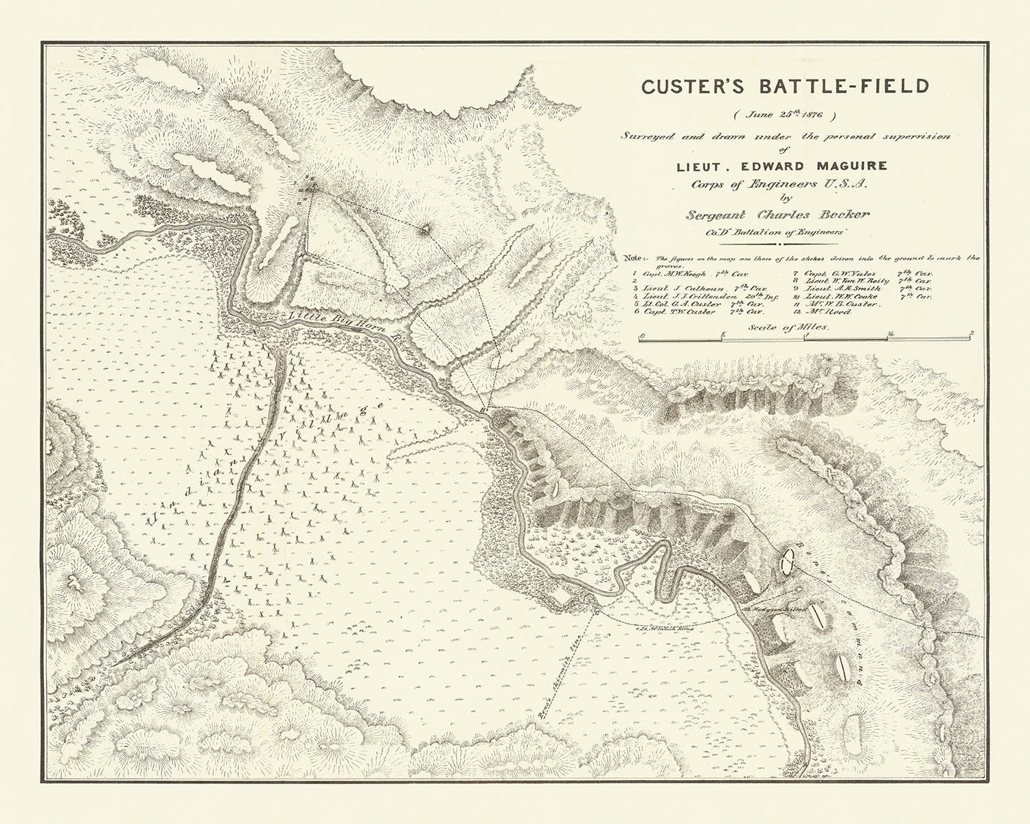
Continue readingCuster's Battle-Field (June 25th, 1876), created by the U.S. Army Corps of Engineers through the direct supervision of Lieutenant Edward Maguire, stands as one of the most authoritative historical maps capturing the moments of the Battle of the Little Bighorn, also infamously known as Custer's Last Stand. Produced in 1876 shortly after the fateful clash, this copperplate engraving provides extraordinary detail about the site of Lt. Col. George Armstrong Custer’s defeat near the mouth of the Bighorn River in southeastern Montana. The map was meticulously surveyed as Maguire accompanied rescue forces to the battlefield, creating a cartographic document that serves not just as a navigational tool but as a testimonial to a pivotal event in the American West.
This fine art print, available exclusively from The Unique Maps Co., faithfully recreates the original copperplate engraving on acid-free archival paper or artist’s cotton canvas—your choice to suit any interior setting. Sizes are customizable, and professional framing as well as bespoke personalization options are available to create a truly meaningful artifact or commemorative display.
The U.S. Army Corps of Engineers, tasked with both strategic military mapping and topographic surveys during the post-Civil War period, gained enduring renown for works such as this due to their painstaking accuracy and attention to historical consequence. The map was drawn under the technical direction of Lieutenant Maguire and artistically rendered by Sergeant Charles Becker, highlighting their combined expertise in both the science and art of battlefield cartography. By recording every significant detail, including river contours, topographical features, and marked troop positions, their work provided critical insights into the dramatic outcome of the Great Sioux War of 1876.
Custer's Battle-Field map is of particular historical importance as it enumerates not just the courses of the Little Bighorn and surrounding rivers, but solemnly marks the grave sites of fallen officers and soldiers, including Lt. Col. Custer himself. Points of interest—such as the exact segment of Reno’s skirmish line, the extensive Indigenous encampments, and the locations where the fiercest fighting unfolded—are named and clearly laid out, guiding the viewer across the entwined narrative of the infamous day. For enthusiasts of American, Indigenous, or military history, this fine art reproduction serves as both a conversation piece and a tool for education or research.
Rendered in crisp sepia, brown, and subtle gray tones, with elaborately hand-etched detail and classically styled cartouches, this print demonstrates the gravitas and elegance of 19th-century military cartography. The subdued tones enhance period authenticity while ensuring the map integrates harmoniously with modern or traditional interiors. The clarity of the linework and typographic elements make this an exemplary item for anyone captivated by historical maps, frontier legend, or the intersection of exploration and conflict. To own this print is to preserve and continually reflect on one of the defining chapters in American memory.
This thoughtfully reproduced map makes a resounding gift for lovers of history, educators, collectors, or anyone enchanted by storied maps and Americana. It is ideal for occasions such as Christmas, Father’s Day, housewarmings, graduations, or as a prized addition to an office, study, library, or teaching space.
If you're not sure what size to order, or you're looking for a custom order of some kind – a different size, a different colour, a special frame – then please contact me. I usually respond within a few minutes.
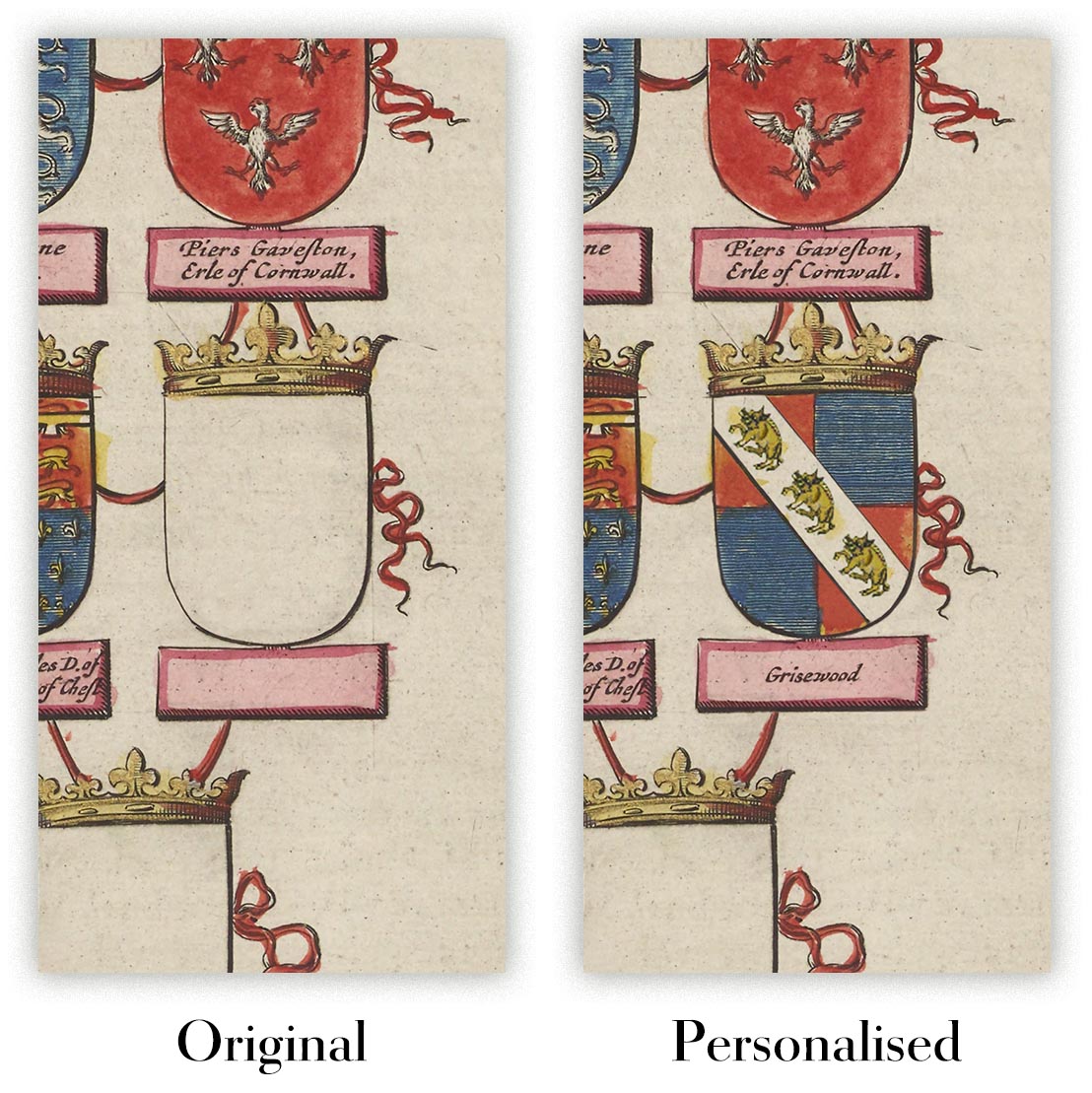
You can see an example of my fine art personalisation service in the fifth image. Zoom in and take a look. My personalised artwork is always very well received. Take a look at more examples of personalisation.
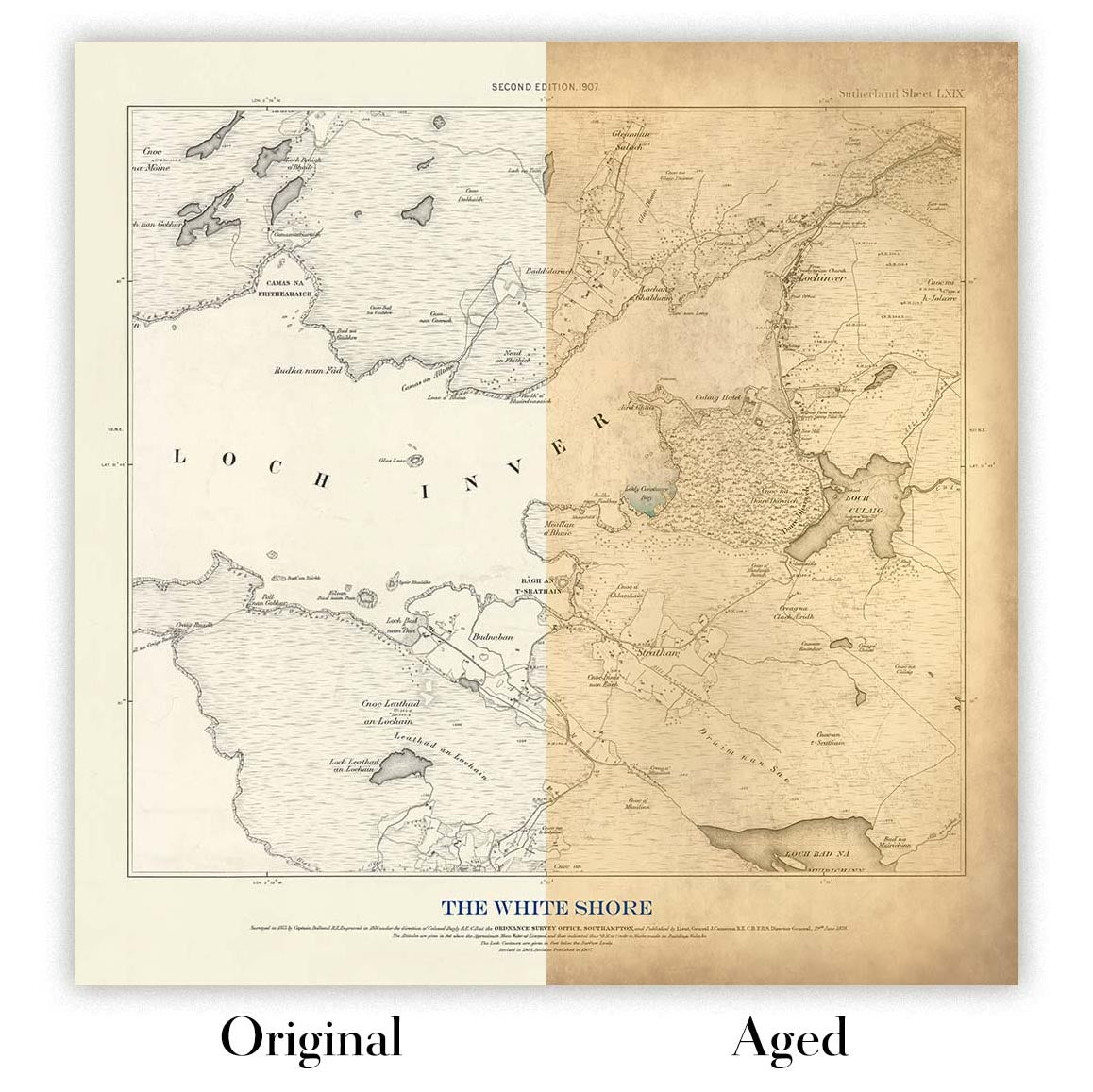
You can also choose to age your art print to make it look older. This is popular amongst my customers who want their artwork to look like an older, antique print. You can see an example of ageing in the sixth product image, or go ahead and check out lots of examples of other aged artwork.
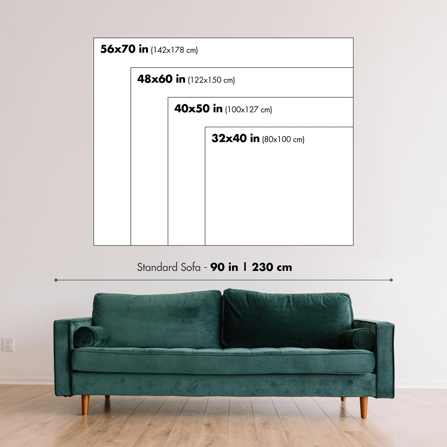
The model in the listing images is holding the 16x20in (40x50cm) version of this art print.
I can print and frame this beautiful piece of art at sizes up to 3 metres (10ft). If you are looking for a size or framing option that isn't available online, please get in touch.
This artwork is available as a giclée print on acid free archival matte paper, or you can buy it framed. My standard frames come in six colours (black, dark brown, dark grey, antique gold, oak and white), and custom framing is available for an additional charge. My frames are glazed with super-clear museum-grade acrylic (perspex/acrylite), which is significantly less reflective than glass, safer, and will always arrive in perfect condition.
This artwork is also available as a float framed canvas, sometimes known as a shadow gap framed canvas or canvas floater. The work is printed on artist's cotton canvas and then stretched over a handmade box frame. We then "float" the canvas inside a wooden frame, which is available in a range of colours (black, dark brown, oak, antique gold and white). This is a wonderful way to present an art print without glazing in front. See some examples of float framed canvas art and explore the differences between my different finishes.
Custer's Battle-Field (June 25th, 1876), created by the U.S. Army Corps of Engineers through the direct supervision of Lieutenant Edward Maguire, stands as one of the most authoritative historical maps capturing the moments of the Battle of the Little Bighorn, also infamously known as Custer's Last Stand. Produced in 1876 shortly after the fateful clash, this copperplate engraving provides extraordinary detail about the site of Lt. Col. George Armstrong Custer’s defeat near the mouth of the Bighorn River in southeastern Montana. The map was meticulously surveyed as Maguire accompanied rescue forces to the battlefield, creating a cartographic document that serves not just as a navigational tool but as a testimonial to a pivotal event in the American West.
This fine art print, available exclusively from The Unique Maps Co., faithfully recreates the original copperplate engraving on acid-free archival paper or artist’s cotton canvas—your choice to suit any interior setting. Sizes are customizable, and professional framing as well as bespoke personalization options are available to create a truly meaningful artifact or commemorative display.
The U.S. Army Corps of Engineers, tasked with both strategic military mapping and topographic surveys during the post-Civil War period, gained enduring renown for works such as this due to their painstaking accuracy and attention to historical consequence. The map was drawn under the technical direction of Lieutenant Maguire and artistically rendered by Sergeant Charles Becker, highlighting their combined expertise in both the science and art of battlefield cartography. By recording every significant detail, including river contours, topographical features, and marked troop positions, their work provided critical insights into the dramatic outcome of the Great Sioux War of 1876.
Custer's Battle-Field map is of particular historical importance as it enumerates not just the courses of the Little Bighorn and surrounding rivers, but solemnly marks the grave sites of fallen officers and soldiers, including Lt. Col. Custer himself. Points of interest—such as the exact segment of Reno’s skirmish line, the extensive Indigenous encampments, and the locations where the fiercest fighting unfolded—are named and clearly laid out, guiding the viewer across the entwined narrative of the infamous day. For enthusiasts of American, Indigenous, or military history, this fine art reproduction serves as both a conversation piece and a tool for education or research.
Rendered in crisp sepia, brown, and subtle gray tones, with elaborately hand-etched detail and classically styled cartouches, this print demonstrates the gravitas and elegance of 19th-century military cartography. The subdued tones enhance period authenticity while ensuring the map integrates harmoniously with modern or traditional interiors. The clarity of the linework and typographic elements make this an exemplary item for anyone captivated by historical maps, frontier legend, or the intersection of exploration and conflict. To own this print is to preserve and continually reflect on one of the defining chapters in American memory.
This thoughtfully reproduced map makes a resounding gift for lovers of history, educators, collectors, or anyone enchanted by storied maps and Americana. It is ideal for occasions such as Christmas, Father’s Day, housewarmings, graduations, or as a prized addition to an office, study, library, or teaching space.
If you're not sure what size to order, or you're looking for a custom order of some kind – a different size, a different colour, a special frame – then please contact me. I usually respond within a few minutes.
You can see an example of my fine art personalisation service in the fifth image. Zoom in and take a look. My personalised artwork is always very well received. Take a look at more examples of personalisation.
You can also choose to age your art print to make it look older. This is popular amongst my customers who want their artwork to look like an older, antique print. You can see an example of ageing in the sixth product image, or go ahead and check out lots of examples of other aged artwork.
The model in the listing images is holding the 16x20in (40x50cm) version of this art print.
I can print and frame this beautiful piece of art at sizes up to 3 metres (10ft). If you are looking for a size or framing option that isn't available online, please get in touch.
This artwork is available as a giclée print on acid free archival matte paper, or you can buy it framed. My standard frames come in six colours (black, dark brown, dark grey, antique gold, oak and white), and custom framing is available for an additional charge. My frames are glazed with super-clear museum-grade acrylic (perspex/acrylite), which is significantly less reflective than glass, safer, and will always arrive in perfect condition.
This artwork is also available as a float framed canvas, sometimes known as a shadow gap framed canvas or canvas floater. The work is printed on artist's cotton canvas and then stretched over a handmade box frame. We then "float" the canvas inside a wooden frame, which is available in a range of colours (black, dark brown, oak, antique gold and white). This is a wonderful way to present an art print without glazing in front. See some examples of float framed canvas art and explore the differences between my different finishes.
Many of our maps and art prints are chosen as thoughtful gifts for homes, offices, studies and meaningful places.
Choose a framed option for the easiest ready-to-hang gift, or choose an unframed print if the recipient may prefer to select their own frame.
We make orders locally in 24 countries around the world, so gifts can often be produced close to the recipient. This helps them arrive faster, travel more safely, and avoid customs or import duty surprises.
- We can deliver directly to the recipient
- Framed pieces arrive ready to hang
- Unframed prints are carefully packed in a strong protective tube
- Almost every order is made locally, for faster, safer gifting
- 90-day returns give the recipient time to decide
If you are not sure what to choose, please contact us. We can help you pick the right map, size, finish or delivery option.
Most orders are made locally and delivered in around 2–3 working days, depending on the product, size and destination.
We print and frame maps and artwork in 24 countries around the world, so your order is usually made close to you or your recipient. That means faster delivery, less time in transit, and no customs or import duty surprises.
Personalised and customised pieces usually take an extra 1–2 working days, because we prepare your design and send it to you for approval before printing.
Very large framed orders can take a little longer, as they need extra care in production and delivery.
Every order is carefully packaged: unframed prints are sent in a strong protective tube, while framed pieces are securely packed with protective materials around the frame.
If you need your order by a particular date, please contact us before ordering. We’ll check the best production route and delivery option for your location.
Express delivery is available at checkout for most countries. Next-day delivery is available in the UK, US, Singapore and the UAE.
Your order is covered by our 90-day returns policy and 10-year guarantee.
Our standard frame is a gallery-style black ash hardwood frame, with a simple, modern look. It is approximately 20mm (0.8in) wide. You can also view some lovely customer photos of framed maps and art.
We use super-clear acrylic glazing, also known as Perspex or Acrylite, instead of traditional glass. It is lighter, safer, and has lower reflectivity, giving the artwork a clearer, cleaner appearance.
Six standard frame colours are available at no extra cost: black, dark brown, dark grey, oak, white, and antique gold. Custom framing and mounting/matting is also available for customers looking for something more specific.
Most maps, art prints, and illustrations are also available as a framed canvas. We use matte cotton canvas, stretch it over a sustainably sourced wooden box frame, and then float the piece within a wooden outer frame. The finished result is beautifully presented, with no glazing between you and the artwork.
All frames are supplied ready to hang, with either string or brackets fitted to the back. Very large frames will include heavy-duty hanging plates and/or a mounting baton. If you have any questions, please get in touch.
We can also supply old maps and artwork on canvas, foam board, cotton rag, and other materials.
If you would prefer to frame your map or artwork yourself, please read our size guide before ordering.
We work with interior designers, hospitality businesses, property professionals, offices and corporate buyers on individual pieces and larger coordinated projects.
This artwork can be adapted for a particular wall, room or project, and our workshop can help coordinate the dimensions, material and framing before production.
- Exact, oversized and made-to-measure dimensions
- Custom framing, mounting and alternative materials
- Coordinated pieces for several rooms or locations
- Art personalisation, to adjust the colour and style of the piece
- Art and framing guidance from our workshop
- Local production for projects around the world
Every restored art print begins with the original artist’s work—never an AI-generated replacement.
Our London studio works from carefully selected source material from museums, libraries, archives and private collections. We restore age-related damage, faded colour and imperfect reproduction while preserving the artist’s composition, brushwork, line, texture and period character.
We do not use generative AI to redraw, reinterpret or invent the artwork. Digital restoration is used only to recover and reproduce the original work as faithfully as possible.
Once restored, the master artwork is prepared for your chosen size and finish. Your piece is then printed and, where selected, framed close to its delivery destination.
Our giclée art prints use acid-free 200gsm archival matte paper and fade-resistant pigment inks for a rich, museum-quality finish. Framed art prints use crystal-clear optical acrylic and arrive ready to hang.
Framed canvas and specialist cotton-rag editions are also available. Learn more about our materials and finishes.
We’ve been restoring and producing maps and art prints since 1984, and we stand behind every piece.
Every order is covered by our 10-year guarantee and damage-free delivery guarantee. If your piece arrives damaged, we’ll replace or remake it free of charge. If anything else isn’t right, contact our workshop team and we’ll put it right promptly.
See our returns and refund policy for full details.


