


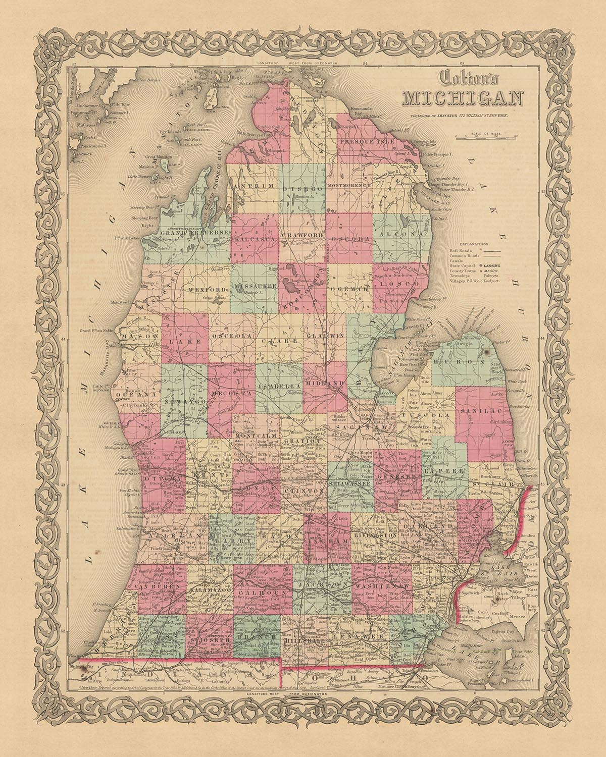
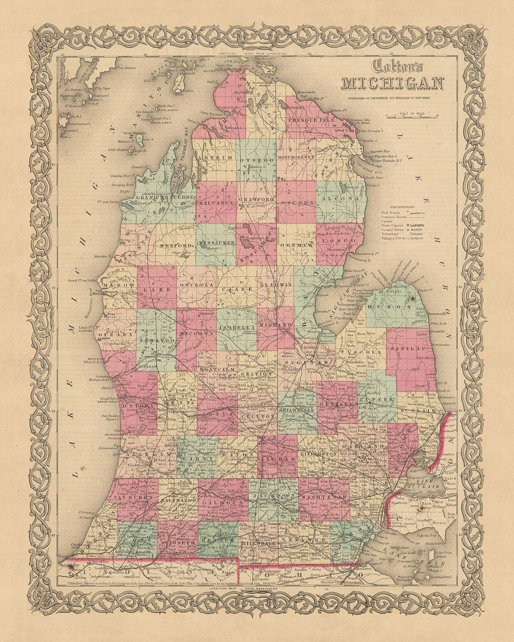


Rare Old Map of Michigan by J.H. Colton, 1855: Detroit, Grand Rapids, Ann Arbor, Lansing, Kalamazoo
The price will update when you pick
different sizes and framing below

-
FREE delivery in 2 to 3 days
Free delivery in 2 to 3 days
Your map should be delivered in 2 to 3 working days with free delivery, worldwide.
We make maps by hand locally in 23 countries, including the USA
![]() . If you're buying a gift for someone in another country, we will make the map locally to them.
. If you're buying a gift for someone in another country, we will make the map locally to them.You will never pay import tax or customs duty.
Express delivery is available at checkout which can reduce the delivery time to 1-2 days.
Please note that personalised maps, and larger framed maps, can take longer to produce and deliver.
If you need your order to arrive by a certain date, contact me and we can discuss your options.
-
Certified sustainable +
we plant trees🌳
Sustainability & Tree Planting
Here at The Unique Maps Co., we have an unusually high affinity for paper. After all, without paper, there can be no maps!
That's why all of our paper, frames and packaging are from FSC certified sources.
But we don't stop there. We've partnered with Treeapp to plant trees around the world.
If you spend $60 or more, we'll plant a tree in your name.
We also cover the costs of offsetting the carbon emissions on all deliveries.
- Framing & free personalisation available
-
90 day money back guarantee
90 days to return and refund
Products can be returned within 90 days for a full refund, or exchange for another product.
For personalised or custom made items, we may offer you a non-expiring gift card, as we cannot resell personalised orders.
If you have any questions, get in touch. For more information, see our full returns & exchanges policy.
My maps are rare, museum-grade, restored old maps sourced from libraries, auction houses and private collections across the globe.
Custom size and finish

If you are looking for a size or finish that is not available here, please request it in the "order note" when you check out.
Every order is custom made, so if you need the size adjusted slightly, or printed on an unusual material, just let us know. We've done thousands of custom orders over the years, so there's (almost) nothing we can't manage.
You can also contact us before you order, if you prefer!
- FREE 2-3 day worldwide delivery
- 90 day money back guarantee
- Handmade, museum-grade quality


This remarkable piece is an authentic 1855 map of Michigan, meticulously crafted by J.H. Colton, one of the most esteemed American mapmakers of his time. The map offers a rare glimpse into the nascent stages of the United States, a period when many settlements were yet to be founded, and the landscape of the nation was in a constant state of flux. As such, it provides a unique opportunity to observe the evolution of American history and cartography.
The map captures Michigan during a fascinating period of its history. In 1855, the state was just 18 years into its statehood, and many of its modern-day cities and towns were in their infancy or yet to be established. This makes the map a valuable resource for understanding the early development of Michigan and its role in the broader narrative of American history.
It's important to note that over the last 150 years, many names and borders have changed. The locations that were prominent in 1855 may not be the same as those we know today. This map, therefore, not only documents the geography of the time but also chronicles the dynamic nature of societal and territorial changes that have shaped the state of Michigan.
The map highlights five notable settlements that existed in Michigan in 1855: Detroit, Grand Rapids, Ann Arbor, Lansing, and Kalamazoo. Detroit, the largest city and the future automotive capital of the world, was already a bustling hub. Grand Rapids, known for its furniture production, was beginning to grow. Ann Arbor, home to the University of Michigan founded just 18 years prior, was a beacon of education and culture. Lansing, not yet the capital but a thriving town, and Kalamazoo, an important junction between Detroit and Chicago, are also featured.
J.H. Colton, the creator of this map, is generally considered the finest American mapmaker of this era. His maps are known for their accuracy, detail, and aesthetic appeal. This map of Michigan is no exception. It exhibits Colton's signature style and attention to detail, making it a prized possession for any collector or enthusiast.
In conclusion, this 1855 map of Michigan by J.H. Colton is a historical artifact of immense value. It provides a snapshot of a time when the United States was still young, and its future was being written. It is a testament to the skill and artistry of its creator and a window into the past that continues to shape the present. This map is more than just a representation of geographical information; it's a piece of history that tells a story of a time and place that has long since evolved.
Notable Settlements in Michigan, 1855
- Detroit (1701): Known as the "Paris of the West" for its architecture and growth. It was the largest city in Michigan in 1855 and later became the world's automotive capital.
- Sault Ste. Marie (1668): The oldest city in Michigan and the third oldest in the United States, it was a critical site for trade and commerce.
- Mackinac Island (1670): Known for its strategic location for the fur trade, it was a center of commerce and military importance.
- Marquette (1849): A major port on Lake Superior, it played a crucial role in the iron ore shipping industry.
- Ann Arbor (1824): Home to the University of Michigan, it was a beacon of education and culture.
- Grand Rapids (1826): Known for its furniture industry, it was a significant economic center.
- Lansing (1847): Although not yet the capital in 1855, it was a thriving town.
- Kalamazoo (1829): An important junction between Detroit and Chicago.
- Pontiac (1818): Named after the famous Ottawa leader, it was a significant carriage and wagon manufacturing center.
- Flint (1819): Known as "Vehicle City" for its carriage manufacturing industry before the rise of the automobile.
- Saginaw (1819): A thriving hub for the lumber industry.
- Monroe (1785): The site of the River Raisin Massacre during the War of 1812.
- Jackson (1829): Known for its large prison, the Michigan State Prison.
- Battle Creek (1831): Future birthplace of the Kellogg Company.
- Adrian (1826): A significant hub for the manufacturing of carriages and sleighs.
- Traverse City (1847): Known for its lumber and shipping industry.
- Bay City (1837): A prominent center for shipbuilding and lumber.
- Lapeer (1831): Known for its lumber industry.
- Muskegon (1837): A significant port on Lake Michigan and a center for the lumber industry.
- Niles (1827): Known for its manufacturing and railroad repair facilities.
Native American Tribes in Michigan, 1855
- Ojibwe (Chippewa): One of the largest tribes in North America, they occupied large portions of Michigan.
- Ottawa: Known as traders, they lived primarily in the western part of Lower Michigan.
- Potawatomi: They inhabited areas in southern and western Michigan.
- Wyandot (Huron): They lived primarily in the southeastern part of the state.
Notable Natural Features in Michigan, 1855
- Lake Michigan: One of the five Great Lakes of North America, it's the only one located entirely within the United States.
- Lake Superior: The largest of the Great Lakes, and the largest freshwater lake in the world by surface area.
- Lake Huron: The second largest of the Great Lakes, it's home to the largest freshwater island in the world, Manitoulin Island.
- Lake Erie: The smallest of the Great Lakes by volume, it's known for its fishing industry.
- Mackinac Island: Known for its limestone formations like Arch Rock.
- Pictured Rocks National Lakeshore: Known for its sandstone cliffs, it's now a popular tourist attraction.
- Sleeping Bear Dunes: Large sand dunes located on the Lake Michigan coastline.
Historical Events in Michigan, 1810-1855
- War of 1812 (1812-1815): Several battles were fought in Michigan, including the Battle of Mackinac Island and the Battle of Frenchtown.
- Toledo War (1835-1836): A boundary dispute between Michigan and Ohio over the Toledo Strip.
- Michigan becomes the 26th state (1837): Michigan was admitted to the Union on January 26, 1837.
- Sojourner Truth (1851): The famous abolitionist and women's rights activist delivered her "Ain't I a Woman?" speech in Battle Creek.
Please double check the images to make sure that a specific town or place is shown on this map. You can also get in touch and ask us to check the map for you.
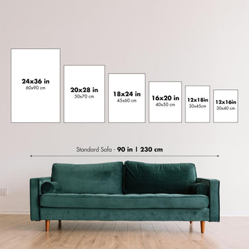
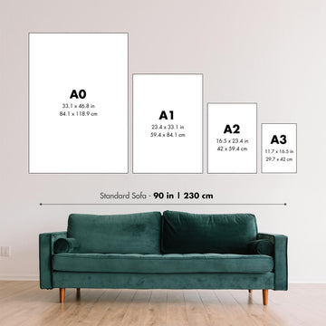
This map looks great at all sizes: 12x16in (30.5x41cm), 16x20in (40.5x51cm), 18x24in (45.5x61cm), 24x30in (61x76cm), 32x40in (81.5x102cm), 40x50in (102x127cm), 48x60in (122x153cm) and 56x70in (142x178cm), but it looks even better when printed large.
I can create beautiful, large prints of this map up to 70in (178cm). Please get in touch if you're looking for larger, customised or different framing options.
The model in the listing images is holding the 16x20in (40.5x51cm) version of this map.
The fifth listing image shows an example of my map personalisation service.
If you’re looking for something slightly different, check out my main collection of USA and North America maps.
Please contact me to check if a certain location, landmark or feature is shown on this map.
This would make a wonderful birthday, Christmas, Father's Day, work leaving, anniversary or housewarming gift for someone from the areas covered by this map.
This map is available as a giclée print on acid free archival matte paper, or you can buy it framed. The frame is a nice, simple black frame that suits most aesthetics. Please get in touch if you'd like a different frame colour or material. My frames are glazed with super-clear museum-grade acrylic (perspex/acrylite), which is significantly less reflective than glass, safer, and will always arrive in perfect condition.
This map is also available as a float framed canvas, sometimes known as a shadow gap framed canvas or canvas floater. The map is printed on artist's cotton canvas and then stretched over a handmade box frame. We then "float" the canvas inside a wooden frame, which is available in a range of colours (black, dark brown, oak, antique gold and white). This is a wonderful way to present a map without glazing in front. See some examples of float framed canvas maps and explore the differences between my different finishes.
For something truly unique, this map is also available in "Unique 3D", our trademarked process that dramatically transforms the map so that it has a wonderful sense of depth. We combine the original map with detailed topography and elevation data, so that mountains and the terrain really "pop". For more info and examples of 3D maps, check my Unique 3D page.
For most orders, delivery time is about 3 working days. Personalised and customised products take longer, as I have to do the personalisation and send it to you for approval, which usually takes 1 or 2 days.
Please note that very large framed orders usually take longer to make and deliver.
If you need your order to arrive by a certain date, please contact me before you order so that we can find the best way of making sure you get your order in time.
I print and frame maps and artwork in 23 countries around the world. This means your order will be made locally, which cuts down on delivery time and ensures that it won't be damaged during delivery. You'll never pay customs or import duty, and we'll put less CO2 into the air.
All of my maps and art prints are well packaged and sent in a rugged tube if unframed, or surrounded by foam if framed.
I try to send out all orders within 1 or 2 days of receiving your order, though some products (like face masks, mugs and tote bags) can take longer to make.
If you select Express Delivery at checkout your order we will prioritise your order and send it out by 1-day courier (Fedex, DHL, UPS, Parcelforce).
Next Day delivery is also available in some countries (US, UK, Singapore, UAE) but please try to order early in the day so that we can get it sent out on time.
My standard frame is a gallery style black ash hardwood frame. It is simple and quite modern looking. My standard frame is around 20mm (0.8in) wide.
I use super-clear acrylic (perspex/acrylite) for the frame glass. It's lighter and safer than glass - and it looks better, as the reflectivity is lower.
Six standard frame colours are available for free (black, dark brown, dark grey, oak, white and antique gold). Custom framing and mounting/matting is available if you're looking for something else.
Most maps, art and illustrations are also available as a framed canvas. We use matte (not shiny) cotton canvas, stretch it over a sustainably sourced box wood frame, and then 'float' the piece within a wood frame. The end result is quite beautiful, and there's no glazing to get in the way.
All frames are provided "ready to hang", with either a string or brackets on the back. Very large frames will have heavy duty hanging plates and/or a mounting baton. If you have any questions, please get in touch.
See some examples of my framed maps and framed canvas maps.
Alternatively, I can also supply old maps and artwork on canvas, foam board, cotton rag and other materials.
If you want to frame your map or artwork yourself, please read my size guide first.
My maps are extremely high quality reproductions of original maps.
I source original, rare maps from libraries, auction houses and private collections around the world, restore them at my London workshop, and then use specialist giclée inks and printers to create beautiful maps that look even better than the original.
My maps are printed on acid-free archival matte (not glossy) paper that feels very high quality and almost like card. In technical terms the paper weight/thickness is 10mil/200gsm. It's perfect for framing.
I print with Epson ultrachrome giclée UV fade resistant pigment inks - some of the best inks you can find.
I can also make maps on canvas, cotton rag and other exotic materials.
Learn more about The Unique Maps Co.
Map personalisation
If you're looking for the perfect anniversary or housewarming gift, I can personalise your map to make it truly unique. For example, I can add a short message, or highlight an important location, or add your family's coat of arms.
The options are almost infinite. Please see my map personalisation page for some wonderful examples of what's possible.
To order a personalised map, select "personalise your map" before adding it to your basket.
Get in touch if you're looking for more complex customisations and personalisations.
Map ageing
I have been asked hundreds of times over the years by customers if they could buy a map that looks even older.
Well, now you can, by selecting Aged before you add a map to your basket.
All the product photos you see on this page show the map in its Original form. This is what the map looks like today.
If you select Aged, I will age your map by hand, using a special and unique process developed through years of studying old maps, talking to researchers to understand the chemistry of aging paper, and of course... lots of practice!
If you're unsure, stick to the Original colour of the map. If you want something a bit darker and older looking, go for Aged.
If you are not happy with your order for any reason, contact me for a no-quibble refund.
I am very confident you will like your restored map or art print. I have been doing this since 1984. I'm a 5-star Etsy seller. I have sold tens of thousands of maps and art prints and have over 4,000 real 5-star reviews.
I use a unique process to restore maps and artwork that is massively time consuming and labour intensive. Hunting down the original maps and illustrations can take months. I use state of the art and eye-wateringly expensive technology to scan and restore them. As a result, I guarantee my maps and art prints are a cut above the rest - that's why I can offer a no-quibble refund.
Almost all of my maps and art prints look amazing at large sizes (200cm, 6.5ft+) and I can frame and deliver them to you as well, via special oversized courier. Contact me to discuss your specific needs.
Or try searching for something!


