












Rare Old Map of Denver, Colorado by USGS, 1940: Englewood, Littleton & South Platte River
Restaurée dans notre atelier londonien à partir de la carte originale de 1940 et imprimée en qualité musée. Description complète
L’offre du collectionneur
Choisissez deux œuvres éligibles et bénéficiez de 20 % de réduction sur les deux. Choisissez-en trois et celle au prix le plus bas est offerte, pour une économie maximale de 33 %.
Associez librement des cartes standard éligibles et des tirages d’art. Aucun code n’est requis ; l’offre est appliquée automatiquement lors du paiement.
Les configurations standard réalisées sur commande sont incluses. Les formats sur mesure, les créations personnalisées et les œuvres commissionnées sont exclus.
Besoin d’une livraison à différentes adresses ? Contactez-nous avant de commander.L’offre du collectionneur
Choisissez deux œuvres éligibles et bénéficiez de 20 % de réduction sur les deux. Choisissez-en trois et celle au prix le plus bas est offerte, pour une économie maximale de 33 %.
Associez librement des cartes standard éligibles et des tirages d’art. Aucun code n’est requis ; l’offre est appliquée automatiquement lors du paiement.
Les configurations standard réalisées sur commande sont incluses. Les formats sur mesure, les créations personnalisées et les œuvres commissionnées sont exclus.
Besoin d’une livraison à différentes adresses ? Contactez-nous avant de commander. Restauré à Londres • Imprimé et encadré en the USA
Restaurée à partir de la carte originale de 1940 et imprimée en qualité musée. Description complète
Choisissez votre format
Choisissez votre finition


(Plus d’infos)
Message cadeau & finition personnalisée

Si vous souhaitez ajouter un message cadeau, ou une finition (puzzle, panneau en aluminium, etc.) qui n'est pas disponible ici, veuillez le demander dans la "note de commande" lors de votre passage à la caisse.
Chaque commande est fabriquée sur mesure, donc si vous avez besoin d'ajuster légèrement la taille, ou d'imprimer sur un matériau inhabituel, faites-le nous savoir. Nous avons réalisé des milliers de commandes personnalisées au fil des ans, donc il n'y a (presque) rien que nous ne puissions gérer.
Vous pouvez également nous contacter avant de passer votre commande, si vous le souhaitez !
- Fabriqué en the USA. Livraison sûre
- Arrive en parfait état, sinon nous le remplaçons
- Livraison le lendemain disponible
- Besoin d’aide pour commander ? Appeler, envoyer un SMS ou WhatsApp
Faites entrer un morceau d’histoire chez vous
Plus de 8 000 avis 5 étoiles

Titled “Englewood,” this 1940 United States Geological Survey map presents Denver and its southern environs at a revealing moment in the city’s...
Continuer la lectureTitled “Englewood,” this 1940 United States Geological Survey map presents Denver and its southern environs at a revealing moment in the city’s twentieth-century growth. Drawn at a scale of 1:31,680, it captures the relationship between the established urban grid of Denver and the developing communities of Englewood and Littleton, where streets, rail corridors, waterways, and open land meet at the edge of the metropolis. The map’s topographical language is both precise and elegant: contour lines give form to the shallow valleys and subtle ridges of the Colorado Front Range foothill country, while color and linework distinguish settlement, transportation, drainage, and relief with the calm authority characteristic of USGS cartography.
The United States Geological Survey, founded in 1879, became the nation’s foremost scientific mapping institution, combining field observation, triangulation, elevation measurement, and standardized cartographic design. By the time this map was issued, the USGS had refined a visual style that balanced technical accuracy with remarkable readability. Here, Denver is not portrayed as an abstract city plan but as part of a living landscape shaped by rivers, creeks, terraces, and engineered infrastructure. The mapmaker’s discipline is visible in every contour interval and stream trace, offering a measured portrait of place that served planners, engineers, landowners, travelers, and public agencies alike.
The South Platte River forms one of the great organizing features of the map, bending through the Denver area and tying the city to the broader geography of the plains. Bear Creek and Cherry Creek add further structure, their courses marking natural corridors that influenced settlement, transport, and recreation. Around these waterways, the map records parks, neighborhoods, industrial edges, and open tracts, showing how Denver’s growth was already intertwined with the management of water and land. In the semi-arid environment of Colorado’s Front Range, such details are especially meaningful: creeks and river bottoms were not merely scenic features, but essential axes of movement, cultivation, drainage, and urban expansion.
Englewood and Littleton appear as distinct communities south of Denver, each with its own pattern of streets and development while remaining closely connected to the larger city. The presence of places such as Hampden Park and Cohen Park adds a civic and recreational dimension, suggesting a landscape in transition from rural and suburban margins toward denser metropolitan life. The map quietly documents this transformation before the immense postwar expansion that would reshape the Denver region. Roads and neighborhoods shown here offer a snapshot of pre-interstate Colorado, when local routes, rail lines, and creek valleys structured daily movement more visibly than the high-speed corridors that later came to dominate the urban landscape.
As a historical document, “Englewood” is especially compelling because it records Denver’s southern edge before decades of annexation, suburbanization, and infrastructural change altered the region’s appearance. The contour lines reveal the underlying terrain beneath the modern city, reminding the viewer that urban growth unfolded across a subtly varied landscape of slopes, draws, and river terraces. For anyone interested in Colorado history, urban geography, or the evolution of the Denver metropolitan area, the map offers a richly detailed view of a city poised between its nineteenth-century foundations and its mid-century expansion. It is both a scientific survey and a portrait of place, preserving the geography of a pivotal moment in 1940.
Cities, towns and places on this map
- Denver
- Englewood
- Littleton
- Riverside
- Cohen Park
- South Platte River
- Bear Creek
- Hampden Park
- Cherry Creek
- Various streets and neighborhoods within Denver and Englewood
- Nearby valleys and ridges as indicated by contour lines
Historical context & cartographic details
- Historical topographical map titled “Englewood”, dated 1940
- Produced by the United States Geological Survey (USGS)
- Shows Denver, Colorado, and the surrounding area during a period of urban development
- Created in a traditional USGS topographical style
- Uses contour lines to indicate elevation changes and terrain features
- Includes a scale of 1:31,680
- Uses color and clear linework to distinguish landforms, populated areas, and hydrological features
- Provides insight into historical land use, settlement patterns, density, and infrastructure in the Denver area
- Reflects geographic features such as valleys, water bodies, and changes in elevation
Looking for a particular place? Review the detailed images to confirm that the town, landmark or feature you have in mind appears on the map. If you are unsure, ask our workshop to check before you order.
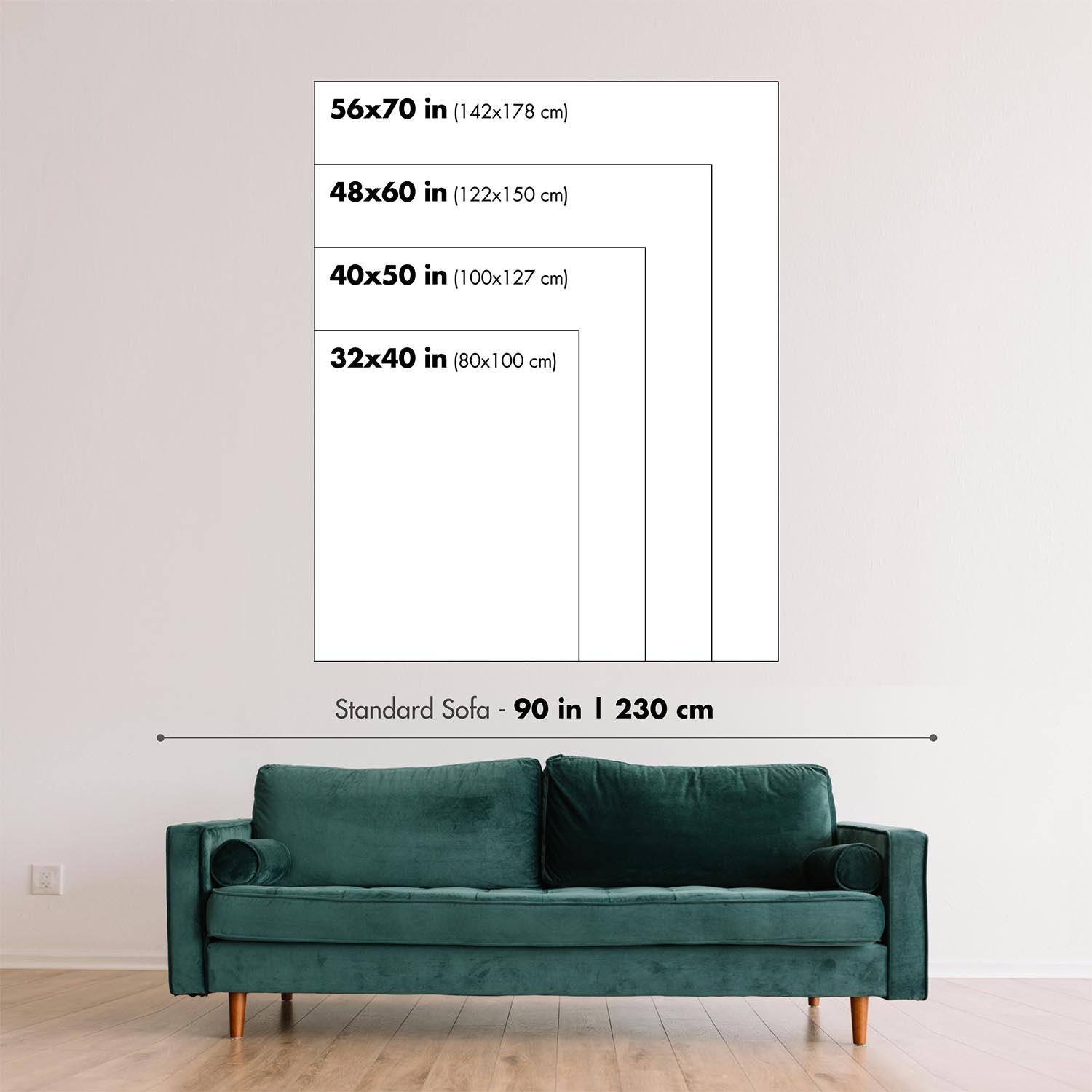
Detailed maps are especially rewarding at larger sizes, where names, boundaries and decorative features have more room to be appreciated. Use the close-up preview and size guide to choose the right scale for your wall.
This map looks amazing at sizes all the way up to 50in (125cm). If you are looking for a larger map, please get in touch.
The model in the listing images is holding the 16x20in (40x50cm) version of this map.
Where personalisation is available, you can add a short title or dedication, mark one meaningful place, or request one considered visual detail. See personalised map examples.
Every piece is printed to museum-grade archival standards using fade-resistant pigment inks on acid-free matte paper. Choose an unframed map print, framed map or canvas using the finish options above. Framed maps use crystal-clear optical acrylic and arrive ready to hang.
With its rich detail and strong sense of place, this map makes a considered gift for a new home, anniversary, retirement or anyone with a personal connection to the area shown. Still deciding? Explore our collection of rare old and vintage maps to discover another place, period or style.
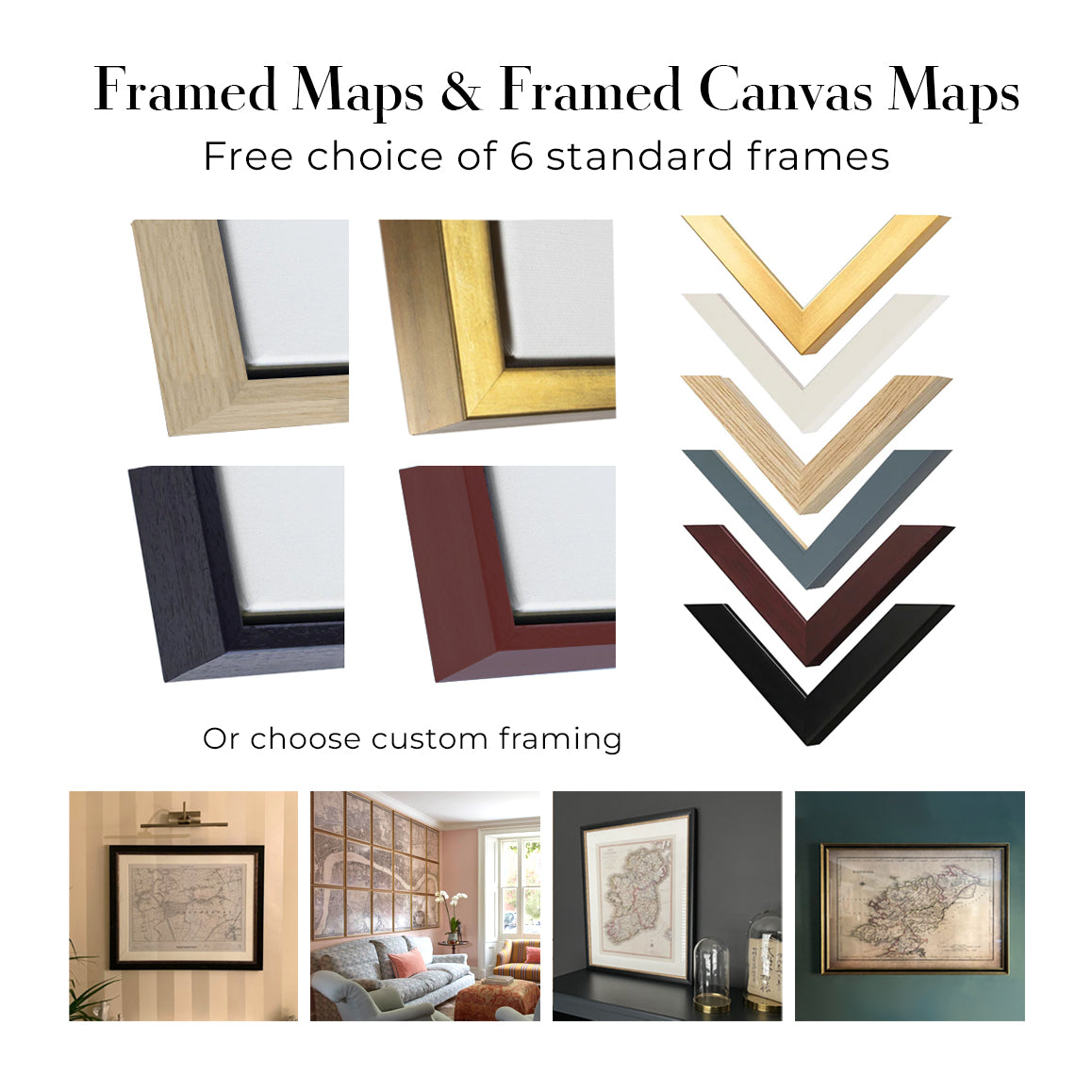
This map is also available as a float framed canvas, sometimes known as a shadow gap framed canvas or canvas floater. The map is printed on artist's cotton canvas and then stretched over a handmade box frame. We then "float" the canvas inside a wooden frame, which is available in a range of colours (black, dark brown, oak, antique gold and white). This is a wonderful way to present a map without glazing in front. See some examples of float framed canvas maps and explore the differences between my different finishes.
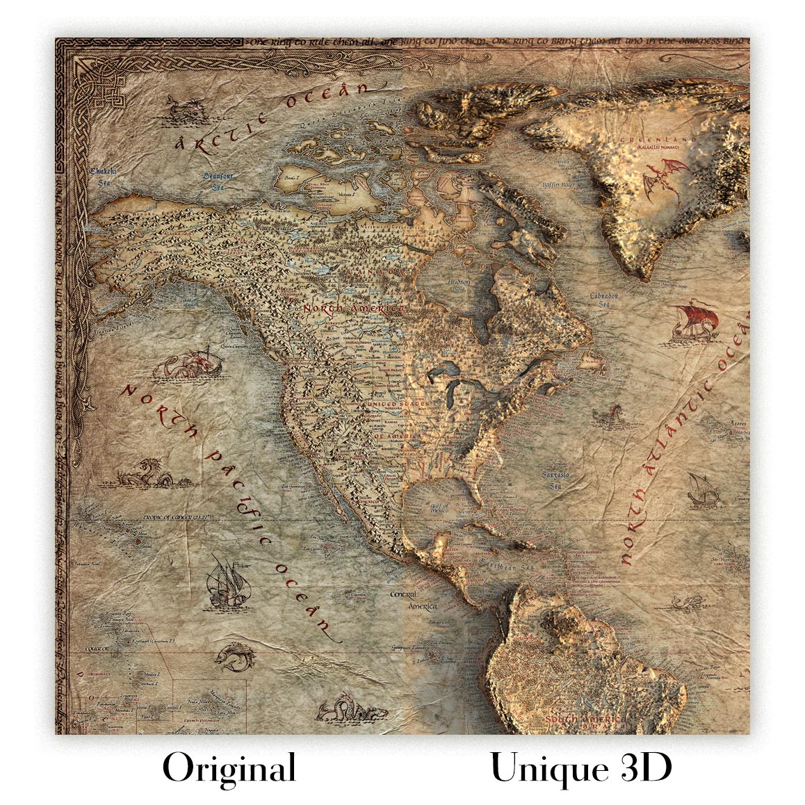
For something truly unique, this map is also available in "Unique 3D", our trademarked process that dramatically transforms the map so that it has a wonderful sense of depth. We combine the original map with detailed topography and elevation data, so that mountains and the terrain really "pop". For more info and examples of 3D maps, check my Unique 3D page.
Titled “Englewood,” this 1940 United States Geological Survey map presents Denver and its southern environs at a revealing moment in the city’s twentieth-century growth. Drawn at a scale of 1:31,680, it captures the relationship between the established urban grid of Denver and the developing communities of Englewood and Littleton, where streets, rail corridors, waterways, and open land meet at the edge of the metropolis. The map’s topographical language is both precise and elegant: contour lines give form to the shallow valleys and subtle ridges of the Colorado Front Range foothill country, while color and linework distinguish settlement, transportation, drainage, and relief with the calm authority characteristic of USGS cartography.
The United States Geological Survey, founded in 1879, became the nation’s foremost scientific mapping institution, combining field observation, triangulation, elevation measurement, and standardized cartographic design. By the time this map was issued, the USGS had refined a visual style that balanced technical accuracy with remarkable readability. Here, Denver is not portrayed as an abstract city plan but as part of a living landscape shaped by rivers, creeks, terraces, and engineered infrastructure. The mapmaker’s discipline is visible in every contour interval and stream trace, offering a measured portrait of place that served planners, engineers, landowners, travelers, and public agencies alike.
The South Platte River forms one of the great organizing features of the map, bending through the Denver area and tying the city to the broader geography of the plains. Bear Creek and Cherry Creek add further structure, their courses marking natural corridors that influenced settlement, transport, and recreation. Around these waterways, the map records parks, neighborhoods, industrial edges, and open tracts, showing how Denver’s growth was already intertwined with the management of water and land. In the semi-arid environment of Colorado’s Front Range, such details are especially meaningful: creeks and river bottoms were not merely scenic features, but essential axes of movement, cultivation, drainage, and urban expansion.
Englewood and Littleton appear as distinct communities south of Denver, each with its own pattern of streets and development while remaining closely connected to the larger city. The presence of places such as Hampden Park and Cohen Park adds a civic and recreational dimension, suggesting a landscape in transition from rural and suburban margins toward denser metropolitan life. The map quietly documents this transformation before the immense postwar expansion that would reshape the Denver region. Roads and neighborhoods shown here offer a snapshot of pre-interstate Colorado, when local routes, rail lines, and creek valleys structured daily movement more visibly than the high-speed corridors that later came to dominate the urban landscape.
As a historical document, “Englewood” is especially compelling because it records Denver’s southern edge before decades of annexation, suburbanization, and infrastructural change altered the region’s appearance. The contour lines reveal the underlying terrain beneath the modern city, reminding the viewer that urban growth unfolded across a subtly varied landscape of slopes, draws, and river terraces. For anyone interested in Colorado history, urban geography, or the evolution of the Denver metropolitan area, the map offers a richly detailed view of a city poised between its nineteenth-century foundations and its mid-century expansion. It is both a scientific survey and a portrait of place, preserving the geography of a pivotal moment in 1940.
Cities, towns and places on this map
- Denver
- Englewood
- Littleton
- Riverside
- Cohen Park
- South Platte River
- Bear Creek
- Hampden Park
- Cherry Creek
- Various streets and neighborhoods within Denver and Englewood
- Nearby valleys and ridges as indicated by contour lines
Historical context & cartographic details
- Historical topographical map titled “Englewood”, dated 1940
- Produced by the United States Geological Survey (USGS)
- Shows Denver, Colorado, and the surrounding area during a period of urban development
- Created in a traditional USGS topographical style
- Uses contour lines to indicate elevation changes and terrain features
- Includes a scale of 1:31,680
- Uses color and clear linework to distinguish landforms, populated areas, and hydrological features
- Provides insight into historical land use, settlement patterns, density, and infrastructure in the Denver area
- Reflects geographic features such as valleys, water bodies, and changes in elevation
Looking for a particular place? Review the detailed images to confirm that the town, landmark or feature you have in mind appears on the map. If you are unsure, ask our workshop to check before you order.
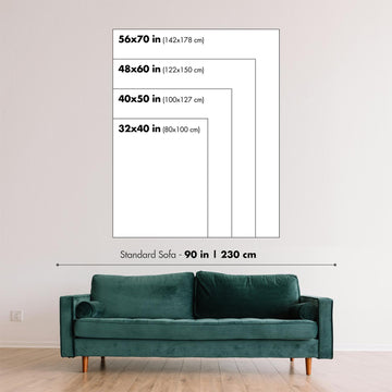
Detailed maps are especially rewarding at larger sizes, where names, boundaries and decorative features have more room to be appreciated. Use the close-up preview and size guide to choose the right scale for your wall.
This map looks amazing at sizes all the way up to 50in (125cm). If you are looking for a larger map, please get in touch.
The model in the listing images is holding the 16x20in (40x50cm) version of this map.
Where personalisation is available, you can add a short title or dedication, mark one meaningful place, or request one considered visual detail. See personalised map examples.
Every piece is printed to museum-grade archival standards using fade-resistant pigment inks on acid-free matte paper. Choose an unframed map print, framed map or canvas using the finish options above. Framed maps use crystal-clear optical acrylic and arrive ready to hang.
With its rich detail and strong sense of place, this map makes a considered gift for a new home, anniversary, retirement or anyone with a personal connection to the area shown. Still deciding? Explore our collection of rare old and vintage maps to discover another place, period or style.
This map is also available as a float framed canvas, sometimes known as a shadow gap framed canvas or canvas floater. The map is printed on artist's cotton canvas and then stretched over a handmade box frame. We then "float" the canvas inside a wooden frame, which is available in a range of colours (black, dark brown, oak, antique gold and white). This is a wonderful way to present a map without glazing in front. See some examples of float framed canvas maps and explore the differences between my different finishes.
For something truly unique, this map is also available in "Unique 3D", our trademarked process that dramatically transforms the map so that it has a wonderful sense of depth. We combine the original map with detailed topography and elevation data, so that mountains and the terrain really "pop". For more info and examples of 3D maps, check my Unique 3D page.
Nombre de nos cartes et tirages d’art sont choisis comme cadeaux attentionnés pour des intérieurs, des bureaux, des cabinets de travail et des lieux chargés de sens.
Choisissez une option encadrée pour un cadeau prêt à être accroché en toute simplicité, ou optez pour un tirage non encadré si le destinataire préfère peut-être sélectionner son propre cadre.
Nous fabriquons les commandes localement dans 23 pays à travers le monde, afin que les cadeaux puissent souvent être produits à proximité du destinataire. Cela permet une livraison plus rapide, un transport plus sûr et d’éviter les surprises liées aux frais de douane ou droits d’importation.
- Nous pouvons livrer directement au destinataire
- Les pièces encadrées arrivent prêtes à être accrochées
- Les tirages non encadrés sont soigneusement emballés dans un tube de protection robuste
- Presque chaque commande est fabriquée localement, pour des cadeaux plus rapides et plus sûrs
- Les retours sous 90 jours laissent au destinataire le temps de se décider
Si vous hésitez sur le choix à faire, veuillez nous contacter. Nous pouvons vous aider à choisir la carte, le format, la finition ou l’option de livraison appropriés.
Pour la plupart des commandes, le délai de livraison est d'environ 3 jours ouvrables. Les produits personnalisés et sur mesure prennent plus de temps, car je dois faire la personnalisation et vous l'envoyer pour approbation, ce qui prend généralement 1 ou 2 jours.
Veuillez noter que les grandes commandes encadrées prennent généralement plus de temps à réaliser et à livrer.
Si vous avez besoin que votre commande arrive à une date précise, veuillez me contacter avant de passer votre commande afin que nous puissions trouver le meilleur moyen de nous assurer que vous receviez votre commande à temps.
J'imprime et encadre des cartes et des œuvres d'art dans 23 pays à travers le monde. Cela signifie que votre commande sera réalisée localement, ce qui réduit le temps de livraison et garantit qu'elle ne sera pas endommagée pendant le transport. Vous ne paierez jamais de droits de douane ou d'importation, et nous mettrons moins de CO2 dans l'air.
Toutes mes cartes et impressions artistiques sont bien emballées et envoyées dans un tube robuste si non encadrées, ou entourées de mousse si encadrées.
J'essaie d'envoyer toutes les commandes dans les 1 ou 2 jours suivant la réception de votre commande, bien que certains produits (comme les masques, les mugs et les sacs fourre-tout) puissent prendre plus de temps à réaliser.
Si vous choisissez Livraison Express lors du paiement, nous donnerons la priorité à votre commande et l'enverrons par un service de messagerie de 1 jour (Fedex, DHL, UPS, Parcelforce).
La livraison le lendemain est également disponible dans certains pays (États-Unis, Royaume-Uni, Singapour, Émirats Arabes Unis), mais veuillez essayer de commander tôt dans la journée afin que nous puissions l'envoyer à temps.
Lisez mon guide complet sur la livraison et la production locale
Mon cadre standard est un cadre en bois dur noir de style galerie. Il est simple et a un aspect assez moderne. Mon cadre standard mesure environ 20 mm (0,8 po) de large.
J'utilise de l'acrylique super clair (perspex/acrylite) pour le verre du cadre. C'est plus léger et plus sûr que le verre - et cela a meilleur aspect, car la réflexivité est plus faible.
Six couleurs de cadre standard sont disponibles gratuitement (noir, marron foncé, gris foncé, chêne, blanc et or antique). Des encadrements et montages/matelassages personnalisés sont disponibles si vous recherchez autre chose.
La plupart des cartes, œuvres d'art et illustrations sont également disponibles sous forme de toile encadrée. Nous utilisons une toile en coton mate (non brillante), que nous tendons sur un cadre en bois de boîte provenant de sources durables, puis nous 'flottions' la pièce à l'intérieur d'un cadre en bois. Le résultat final est assez beau, et il n'y a pas de vitrage qui gêne.
Tous les cadres sont fournis "prêts à accrocher", avec soit une corde, soit des supports à l'arrière. Les très grands cadres auront des plaques de suspension lourdes et/ou une latte de montage. Si vous avez des questions, veuillez nous contacter.
Voir quelques exemples de mes cartes encadrées et de cartes en toile encadrées.
Alternativement, je peux également fournir de vieilles cartes et œuvres d'art sur toile, sur panneau en mousse, en coton et d'autres matériaux.
Si vous souhaitez encadrer votre carte ou œuvre d'art vous-même, veuillez lire d'abord mon guide des tailles.
Nous travaillons avec des architectes d’intérieur, des acteurs de l’hôtellerie, des professionnels de l’immobilier, des bureaux et des acheteurs corporate, pour des pièces individuelles comme pour des projets coordonnés de plus grande envergure.
Cette carte peut être adaptée à un mur, une pièce ou un projet particulier, et notre atelier peut vous aider à coordonner les dimensions, le matériau et l’encadrement avant la production.
- Dimensions exactes, hors format et sur mesure
- Encadrement, montage et matériaux alternatifs sur mesure
- Pièces coordonnées pour plusieurs pièces ou sites
- Personnalisation de la carte, pour marquer des lieux importants ou ajouter des détails supplémentaires
- Conseils sur la carte et l’encadrement par notre atelier
- Production locale pour des projets dans le monde entier
Échangez au sujet de cette pièce avec notre équipe Trade & Projects
Mes cartes sont des reproductions de cartes originales de très haute qualité.
Je recherche des cartes originales et rares auprès de bibliothèques, de maisons de ventes aux enchères et de collections privées du monde entier, je les restaure dans mon atelier de Londres, puis j'utilise des encres et des imprimantes giclées spécialisées pour créer de magnifiques cartes encore plus belles que l'originale.
Mes cartes sont imprimées sur du papier d’archives mat (non brillant) sans acide qui semble de très haute qualité et ressemble presque à une carte. En termes techniques, le grammage/épaisseur du papier est de 10 mil/200 g/m². C'est parfait pour l'encadrement.
J’imprime avec des encres pigmentaires Epson ultrachrome giclée UV résistantes à la décoloration – certaines des meilleures encres que vous puissiez trouver.
je peux aussi faire cartes sur toile, chiffon en coton et autres matériaux exotiques.
En savoir plus sur Unique Maps Co..
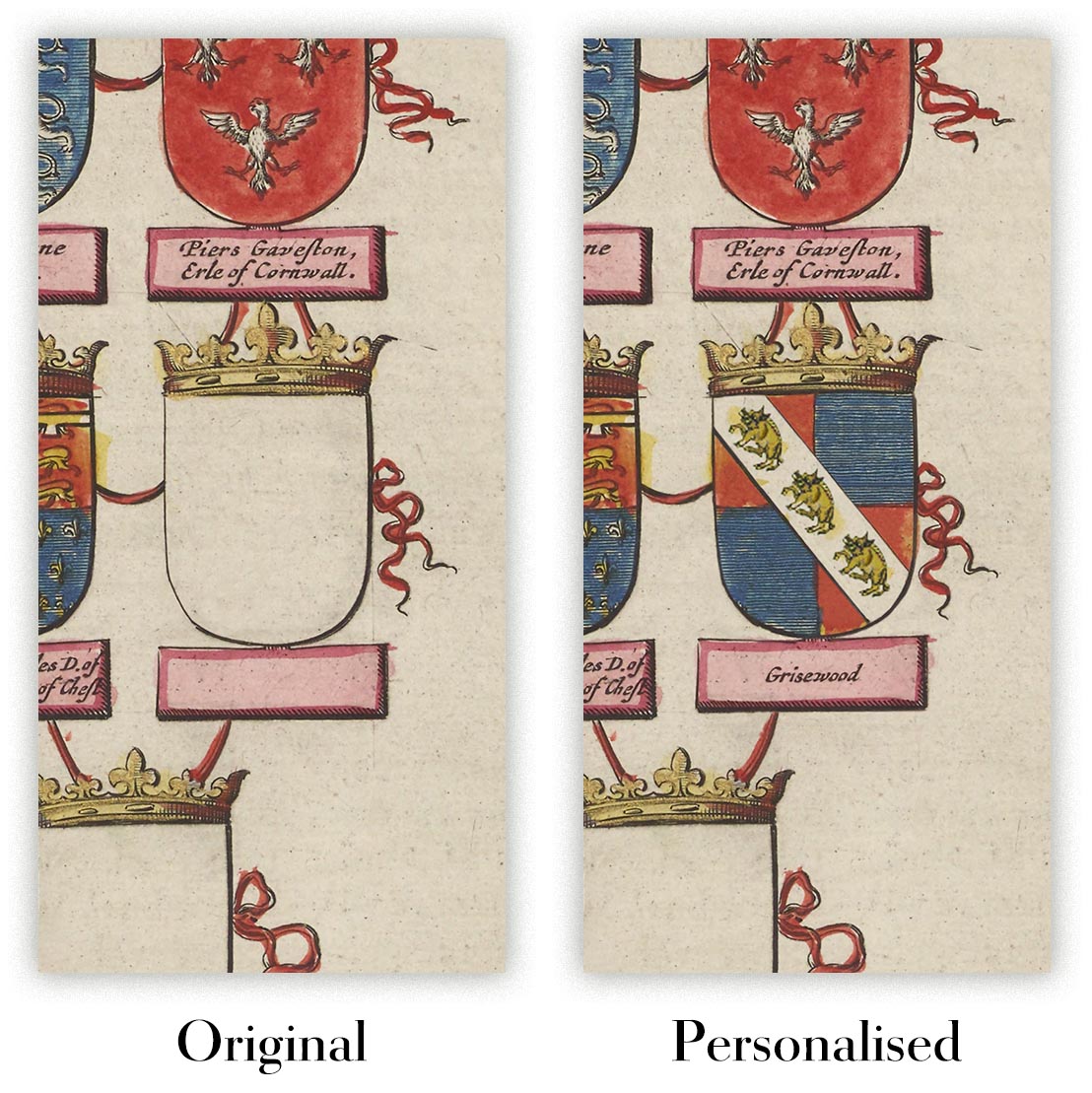
Personnalisation de la carte
Si vous recherchez le cadeau parfait pour un anniversaire ou une pendaison de crémaillère, je peux personnaliser votre carte pour la rendre vraiment unique. Par exemple, je peux ajouter un court message, mettre en évidence un lieu important ou ajouter les armoiries de votre famille.
Les options sont presque infinies. S'il vous plaît voir mon page de personnalisation de la carte pour quelques merveilleux exemples de ce qui est possible.
Pour commander une carte personnalisée, sélectionnez « personnaliser votre carte » avant de l'ajouter à votre panier.
Entrer en contact si vous recherchez des personnalisations et des personnalisations plus complexes.
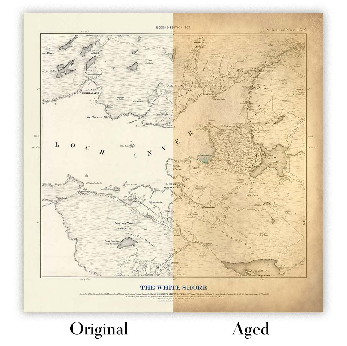
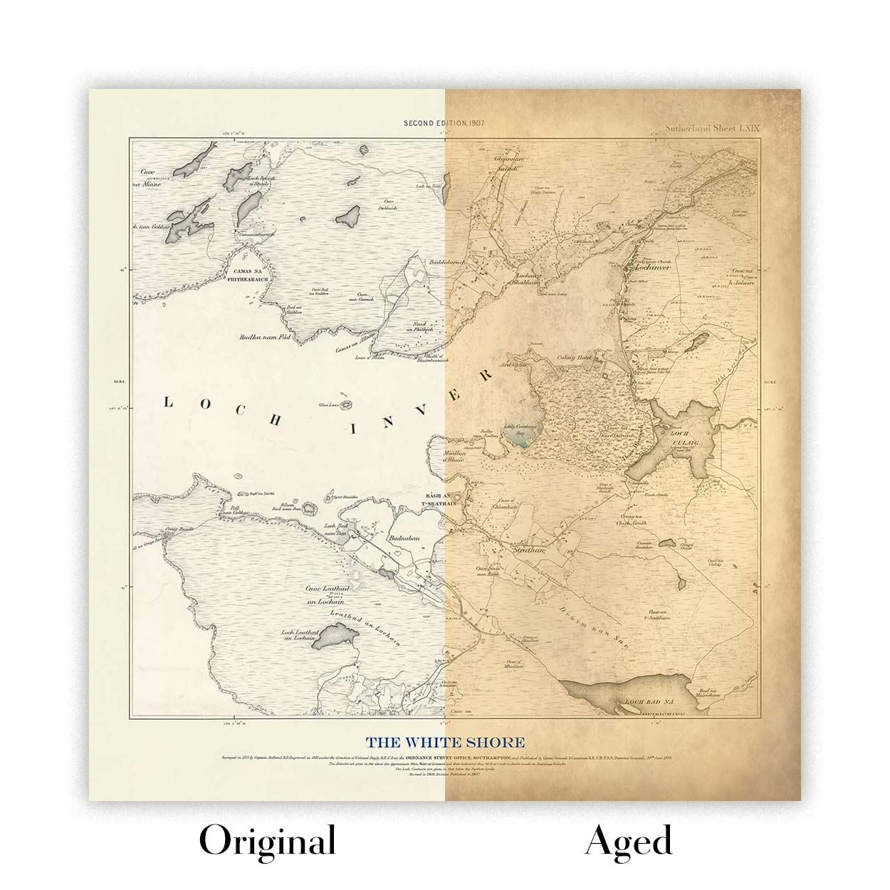
Vieillissement de la carte
Au fil des ans, des clients m'ont demandé des centaines de fois s'ils pouvaient acheter une carte qui semble uniforme. plus vieux.
Eh bien, vous pouvez désormais le faire en sélectionnant Aged avant d'ajouter une carte à votre panier.
Toutes les photos de produits que vous voyez sur cette page montrent la carte dans sa forme originale. Voilà à quoi ressemble la carte aujourd'hui.
Si vous sélectionnez Vieilli, je vieillirai votre carte à la main, en utilisant un processus spécial et unique développé au cours d'années d'étude de cartes anciennes, de discussions avec des chercheurs pour comprendre la chimie du vieillissement du papier, et bien sûr... beaucoup de pratique !
Si vous n'êtes pas sûr, respectez la couleur originale de la carte. Si vous voulez quelque chose d'un peu plus sombre et plus vieux à la recherche, optez pour Aged.
Nous restaurons et produisons des cartes et des tirages d’art depuis 1984, et nous garantissons chaque pièce.
Chaque commande est couverte par notre garantie de 10 ans et notre garantie de livraison sans dommage. Si votre pièce arrive endommagée, nous la remplacerons ou la referons gratuitement. Si quoi que ce soit d’autre ne vous donne pas entière satisfaction, contactez notre équipe d’atelier et nous y remédierons rapidement.
Consultez notre politique de retours et de remboursement pour plus de détails.
Ou lancez une recherche dans la boutique.


