











Rare Old Map of the Moon, 1969: color photomosaic, shaded relief, far-side inset
Œuvre d’art authentique
L’œuvre que nous imprimons est fidèlement restituée à partir de la source originale - généralement un musée, une bibliothèque ou une collection privée. Nous ne remplaçons jamais, ne redessinons jamais et n’inventons jamais le travail de l’artiste à l’aide d’une IA générative.
Restaurée dans notre atelier londonien à partir de l’œuvre originale de 1969 et imprimée en qualité musée. Description complète
L’offre du collectionneur
Choisissez deux œuvres éligibles et bénéficiez de 20 % de réduction sur les deux. Choisissez-en trois et celle au prix le plus bas est offerte, pour une économie maximale de 33 %.
Associez librement des cartes standard éligibles et des tirages d’art. Aucun code n’est requis ; l’offre est appliquée automatiquement lors du paiement.
Les configurations standard réalisées sur commande sont incluses. Les formats sur mesure, les créations personnalisées et les œuvres commissionnées sont exclus.
Besoin d’une livraison à différentes adresses ? Contactez-nous avant de commander.L’offre du collectionneur
Choisissez deux œuvres éligibles et bénéficiez de 20 % de réduction sur les deux. Choisissez-en trois et celle au prix le plus bas est offerte, pour une économie maximale de 33 %.
Associez librement des cartes standard éligibles et des tirages d’art. Aucun code n’est requis ; l’offre est appliquée automatiquement lors du paiement.
Les configurations standard réalisées sur commande sont incluses. Les formats sur mesure, les créations personnalisées et les œuvres commissionnées sont exclus.
Besoin d’une livraison à différentes adresses ? Contactez-nous avant de commander. Restauré à Londres • Imprimé et encadré en the USA

Œuvre d’art authentique
L’œuvre que nous imprimons est fidèlement restituée à partir de la source originale - généralement un musée, une bibliothèque ou une collection privée. Nous ne remplaçons jamais, ne redessinons jamais et n’inventons jamais le travail de l’artiste à l’aide d’une IA générative.
Restaurée à partir de l’œuvre originale de 1969 et imprimée en qualité musée. Description complète
Choisissez votre format
Choisissez votre finition


(Plus d’infos)
Message cadeau & finition personnalisée

Si vous souhaitez ajouter un message cadeau, ou une finition (puzzle, panneau en aluminium, etc.) qui n'est pas disponible ici, veuillez le demander dans la "note de commande" lors de votre passage à la caisse.
Chaque commande est fabriquée sur mesure, donc si vous avez besoin d'ajuster légèrement la taille, ou d'imprimer sur un matériau inhabituel, faites-le nous savoir. Nous avons réalisé des milliers de commandes personnalisées au fil des ans, donc il n'y a (presque) rien que nous ne puissions gérer.
Vous pouvez également nous contacter avant de passer votre commande, si vous le souhaitez !
- Fabriqué en the USA. Livraison sûre
- Arrive en parfait état, sinon nous le remplaçons
- Livraison le lendemain disponible
- Besoin d’aide pour commander ? Appeler, envoyer un SMS ou WhatsApp
Le choix des collectionneurs, des décorateurs et de ceux qui souhaitent faire plaisir
Plus de 8 000 avis 5 étoiles


Created in 1969 at the height of the Apollo era, the Aeronautical Chart and Information Center’s Map of the Moon is a...
Continuer la lectureCreated in 1969 at the height of the Apollo era, the Aeronautical Chart and Information Center’s Map of the Moon is a compelling synthesis of science, cartography, and exploration. Its chief subjects are lunar geography and topography, presented through a color photo mosaic enhanced by expert relief shading that lends the surface a striking three-dimensional presence. Place names, orientation marks at the poles, and a neatly organized coordinate grid frame an atlas-like portrait of the Moon at the very moment it became a navigable world. An inset of the far side completes the global view, making this map both a historical landmark of the space race and an enduring key to understanding our nearest celestial neighbor.
The map’s infographics translate complex geological information into intuitive visual language. High-resolution photographic tiles are blended into a seamless mosaic, while shaded relief models the subtleties of crater rims, rilles, and mountainous ramps, clarifying form at a glance. Informational text panels annotate major features and processes, and the labeled grid—using selenographic coordinates—lets viewers pinpoint locations with the precision required for mission planning. Cardinal directions and clearly marked poles resolve lunar orientation challenges that often confuse casual observers, effectively bridging the gap between raw imagery and field-ready chart. The result is a document that reads as both an authoritative reference and a visual narrative of the Moon’s formation and evolution.
Familiar landmarks are rendered with scientific clarity and aesthetic poise. Tycho’s radiant ray system fans across the southern highlands; Copernicus displays its broad, terraced walls and central peaks; Clavius spans the page with nested craters arching in grand procession. On the dark-floored Plato, subtle tone shifts hint at basaltic plains, while the intensely bright Aristarchus stands out as a beacon against surrounding terrain. The great lunar maria—Mare Imbrium, Mare Serenitatis, Mare Tranquillitatis, and Mare Nubium—are distinguished by tonal contrasts and edge-shadowing that outline ancient basins and wrinkle ridges. Mountain arcs and ridgelines rise convincingly from the shading, and discreet scientific symbols flag areas of interest, including markers for prospective landing sites that forecast the next chapters of lunar exploration.
The far-side inset is a concise masterclass in comparative selenography. By isolating the hemisphere long hidden from Earth, it invites a direct visual comparison: densely cratered highlands dominate, maria are scarce, and basin structures differ in character from the familiar near-side seas. The same symbology—place names where established, a fine coordinate mesh, and relief shading—ensures continuity with the main map. Clearly indicated polar references aid orientation in this less intuitive vista. Together, these panels provide a complete, globally consistent dataset that supports everything from classroom discovery to professional study of crustal asymmetry, impact history, and the geologic forces that sculpted the lunar surface.
The ACIC’s cartographic rigor underpins every element. Known for supplying precision charts to aviators and astronauts alike, the center pioneered controlled lunar photomosaics and photogrammetric methods that helped narrow Apollo-era landing choices, including the storied Mare Tranquillitatis. Their style—clean hierarchies of type, measured use of color, and disciplined symbology—derives from aeronautical charting, where legibility is mission-critical. Here, that discipline becomes an elegant design language: labels clarify without clutter, grids guide without distraction, and annotations enrich without overwhelming. As a historical artifact, the map captures the optimism and exactitude of 1969; as a scientific tool, it remains a lucid gateway to the Moon’s grand relief and enduring mysteries.
Places on this map
- Craters:
- Tycho
- Copernicus
- Clavius
- Plato
- Aristarchus
- Maria (Lunar Plains):
- Mare Imbrium
- Mare Serenitatis
- Mare Tranquillitatis
- Mare Nubium
- Highlands: Areas like the lunar highlands visible on the map.
- Ridges and Mountains: Various mountain ranges and ridges in lunar geography.
- Scientific Features: Additional markers indicating potential landing sites for future missions.
Notable Features & Landmarks
- Topographical Shading: Displays the relief of the lunar surface.
- Place Names: Various craters and plains are labeled.
- Inset for Far Side: A visual section dedicated to the Moon's far side.
- North and South Poles: Clearly marked orientation indicating cardinal directions.
- Photo Mosaic Technique: Use of high-resolution images for detailed representation.
- Informational Text: Provides insights into the features of the Moon.
- Coordinates Grid: Labeled rows and columns for navigation reference.
Historical and design context
- Publisher: Created by the Aeronautical Chart and Information Center, United States Air Force in 1969.
- Mapmaker Context: The Aeronautical Chart and Information Center (ACIC) provided crucial mapping services for military and scientific purposes and was pivotal during the lunar exploration era.
- Topics and Themes: The scientific exploration of the Moon, especially during the Apollo program era.
- Topics and Themes: Presentation of data through infographics that communicate complex geological information effectively.
- Countries/Regions Shown: Not applicable, as this map is focused solely on the Moon.
- Historical Significance: Represents the peak of scientific interest in lunar geography during the space race and aids in navigation and research for future lunar missions.
Looking for a particular place? Review the detailed images to confirm that the town, landmark or feature you have in mind appears on the map. If you are unsure, ask our workshop to check before you order.
Detailed maps are especially rewarding at larger sizes, where names, boundaries and decorative features have more room to be appreciated. Use the close-up preview and size guide to choose the right scale for your wall.
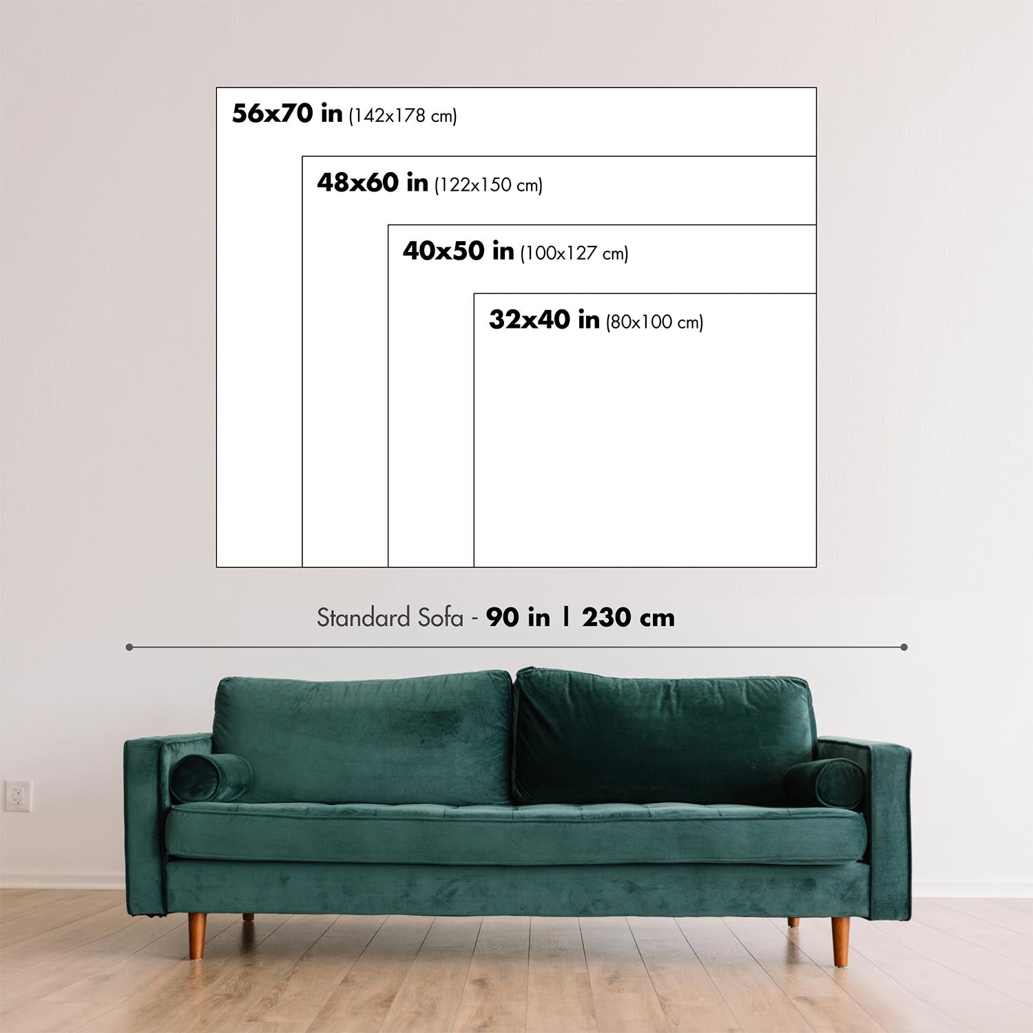
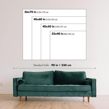
This map looks amazing at sizes all the way up to 90in (230cm). If you are looking for a larger map, please get in touch.
The model in the listing images is holding the 18x24in (45x60cm) version of this map.
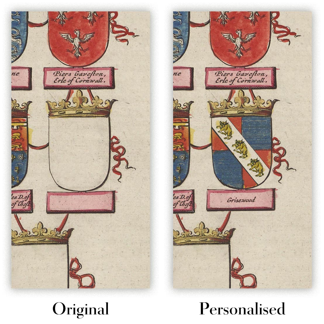
Where personalisation is available, you can add a short title or dedication, mark one meaningful place, or request one considered visual detail. See personalised map examples.
Every piece is printed to museum-grade archival standards using fade-resistant pigment inks on acid-free matte paper. Choose an unframed map print, framed map or canvas using the finish options above. Framed maps use crystal-clear optical acrylic and arrive ready to hang.
With its rich detail and strong sense of place, this map makes a considered gift for a new home, anniversary, retirement or anyone with a personal connection to the area shown. Still deciding? Explore our collection of rare old and vintage maps to discover another place, period or style.
This artwork is also available as a float framed canvas, sometimes known as a shadow gap framed canvas or canvas floater. The work is printed on artist's cotton canvas and then stretched over a handmade box frame. We then "float" the canvas inside a wooden frame, which is available in a range of colours (black, dark brown, oak, antique gold and white). This is a wonderful way to present an art print without glazing in front. See some examples of float framed canvas art and explore the differences between my different finishes.
Created in 1969 at the height of the Apollo era, the Aeronautical Chart and Information Center’s Map of the Moon is a compelling synthesis of science, cartography, and exploration. Its chief subjects are lunar geography and topography, presented through a color photo mosaic enhanced by expert relief shading that lends the surface a striking three-dimensional presence. Place names, orientation marks at the poles, and a neatly organized coordinate grid frame an atlas-like portrait of the Moon at the very moment it became a navigable world. An inset of the far side completes the global view, making this map both a historical landmark of the space race and an enduring key to understanding our nearest celestial neighbor.
The map’s infographics translate complex geological information into intuitive visual language. High-resolution photographic tiles are blended into a seamless mosaic, while shaded relief models the subtleties of crater rims, rilles, and mountainous ramps, clarifying form at a glance. Informational text panels annotate major features and processes, and the labeled grid—using selenographic coordinates—lets viewers pinpoint locations with the precision required for mission planning. Cardinal directions and clearly marked poles resolve lunar orientation challenges that often confuse casual observers, effectively bridging the gap between raw imagery and field-ready chart. The result is a document that reads as both an authoritative reference and a visual narrative of the Moon’s formation and evolution.
Familiar landmarks are rendered with scientific clarity and aesthetic poise. Tycho’s radiant ray system fans across the southern highlands; Copernicus displays its broad, terraced walls and central peaks; Clavius spans the page with nested craters arching in grand procession. On the dark-floored Plato, subtle tone shifts hint at basaltic plains, while the intensely bright Aristarchus stands out as a beacon against surrounding terrain. The great lunar maria—Mare Imbrium, Mare Serenitatis, Mare Tranquillitatis, and Mare Nubium—are distinguished by tonal contrasts and edge-shadowing that outline ancient basins and wrinkle ridges. Mountain arcs and ridgelines rise convincingly from the shading, and discreet scientific symbols flag areas of interest, including markers for prospective landing sites that forecast the next chapters of lunar exploration.
The far-side inset is a concise masterclass in comparative selenography. By isolating the hemisphere long hidden from Earth, it invites a direct visual comparison: densely cratered highlands dominate, maria are scarce, and basin structures differ in character from the familiar near-side seas. The same symbology—place names where established, a fine coordinate mesh, and relief shading—ensures continuity with the main map. Clearly indicated polar references aid orientation in this less intuitive vista. Together, these panels provide a complete, globally consistent dataset that supports everything from classroom discovery to professional study of crustal asymmetry, impact history, and the geologic forces that sculpted the lunar surface.
The ACIC’s cartographic rigor underpins every element. Known for supplying precision charts to aviators and astronauts alike, the center pioneered controlled lunar photomosaics and photogrammetric methods that helped narrow Apollo-era landing choices, including the storied Mare Tranquillitatis. Their style—clean hierarchies of type, measured use of color, and disciplined symbology—derives from aeronautical charting, where legibility is mission-critical. Here, that discipline becomes an elegant design language: labels clarify without clutter, grids guide without distraction, and annotations enrich without overwhelming. As a historical artifact, the map captures the optimism and exactitude of 1969; as a scientific tool, it remains a lucid gateway to the Moon’s grand relief and enduring mysteries.
Places on this map
- Craters:
- Tycho
- Copernicus
- Clavius
- Plato
- Aristarchus
- Maria (Lunar Plains):
- Mare Imbrium
- Mare Serenitatis
- Mare Tranquillitatis
- Mare Nubium
- Highlands: Areas like the lunar highlands visible on the map.
- Ridges and Mountains: Various mountain ranges and ridges in lunar geography.
- Scientific Features: Additional markers indicating potential landing sites for future missions.
Notable Features & Landmarks
- Topographical Shading: Displays the relief of the lunar surface.
- Place Names: Various craters and plains are labeled.
- Inset for Far Side: A visual section dedicated to the Moon's far side.
- North and South Poles: Clearly marked orientation indicating cardinal directions.
- Photo Mosaic Technique: Use of high-resolution images for detailed representation.
- Informational Text: Provides insights into the features of the Moon.
- Coordinates Grid: Labeled rows and columns for navigation reference.
Historical and design context
- Publisher: Created by the Aeronautical Chart and Information Center, United States Air Force in 1969.
- Mapmaker Context: The Aeronautical Chart and Information Center (ACIC) provided crucial mapping services for military and scientific purposes and was pivotal during the lunar exploration era.
- Topics and Themes: The scientific exploration of the Moon, especially during the Apollo program era.
- Topics and Themes: Presentation of data through infographics that communicate complex geological information effectively.
- Countries/Regions Shown: Not applicable, as this map is focused solely on the Moon.
- Historical Significance: Represents the peak of scientific interest in lunar geography during the space race and aids in navigation and research for future lunar missions.
Looking for a particular place? Review the detailed images to confirm that the town, landmark or feature you have in mind appears on the map. If you are unsure, ask our workshop to check before you order.
Detailed maps are especially rewarding at larger sizes, where names, boundaries and decorative features have more room to be appreciated. Use the close-up preview and size guide to choose the right scale for your wall.
This map looks amazing at sizes all the way up to 90in (230cm). If you are looking for a larger map, please get in touch.
The model in the listing images is holding the 18x24in (45x60cm) version of this map.
Where personalisation is available, you can add a short title or dedication, mark one meaningful place, or request one considered visual detail. See personalised map examples.
Every piece is printed to museum-grade archival standards using fade-resistant pigment inks on acid-free matte paper. Choose an unframed map print, framed map or canvas using the finish options above. Framed maps use crystal-clear optical acrylic and arrive ready to hang.
With its rich detail and strong sense of place, this map makes a considered gift for a new home, anniversary, retirement or anyone with a personal connection to the area shown. Still deciding? Explore our collection of rare old and vintage maps to discover another place, period or style.
This artwork is also available as a float framed canvas, sometimes known as a shadow gap framed canvas or canvas floater. The work is printed on artist's cotton canvas and then stretched over a handmade box frame. We then "float" the canvas inside a wooden frame, which is available in a range of colours (black, dark brown, oak, antique gold and white). This is a wonderful way to present an art print without glazing in front. See some examples of float framed canvas art and explore the differences between my different finishes.
Nombre de nos cartes et tirages d’art sont choisis comme cadeaux attentionnés pour des intérieurs, des bureaux, des cabinets de travail et des lieux chargés de sens.
Choisissez une option encadrée pour un cadeau prêt à être accroché en toute simplicité, ou optez pour un tirage non encadré si le destinataire préfère peut-être sélectionner son propre cadre.
Nous fabriquons les commandes localement dans 23 pays à travers le monde, afin que les cadeaux puissent souvent être produits à proximité du destinataire. Cela permet une livraison plus rapide, un transport plus sûr et d’éviter les surprises liées aux frais de douane ou droits d’importation.
- Nous pouvons livrer directement au destinataire
- Les pièces encadrées arrivent prêtes à être accrochées
- Les tirages non encadrés sont soigneusement emballés dans un tube de protection robuste
- Presque chaque commande est fabriquée localement, pour des cadeaux plus rapides et plus sûrs
- Les retours sous 90 jours laissent au destinataire le temps de se décider
Si vous hésitez sur le choix à faire, veuillez nous contacter. Nous pouvons vous aider à choisir la carte, le format, la finition ou l’option de livraison appropriés.
Pour la plupart des commandes, le délai de livraison est d'environ 3 jours ouvrables. Les produits personnalisés et sur mesure prennent plus de temps, car je dois faire la personnalisation et vous l'envoyer pour approbation, ce qui prend généralement 1 ou 2 jours.
Veuillez noter que les grandes commandes encadrées prennent généralement plus de temps à réaliser et à livrer.
Si vous avez besoin que votre commande arrive à une date précise, veuillez me contacter avant de passer votre commande afin que nous puissions trouver le meilleur moyen de nous assurer que vous receviez votre commande à temps.
J'imprime et encadre des cartes et des œuvres d'art dans 23 pays à travers le monde. Cela signifie que votre commande sera réalisée localement, ce qui réduit le temps de livraison et garantit qu'elle ne sera pas endommagée pendant le transport. Vous ne paierez jamais de droits de douane ou d'importation, et nous mettrons moins de CO2 dans l'air.
Toutes mes cartes et impressions artistiques sont bien emballées et envoyées dans un tube robuste si non encadrées, ou entourées de mousse si encadrées.
J'essaie d'envoyer toutes les commandes dans les 1 ou 2 jours suivant la réception de votre commande, bien que certains produits (comme les masques, les mugs et les sacs fourre-tout) puissent prendre plus de temps à réaliser.
Si vous choisissez Livraison Express lors du paiement, nous donnerons la priorité à votre commande et l'enverrons par un service de messagerie de 1 jour (Fedex, DHL, UPS, Parcelforce).
La livraison le lendemain est également disponible dans certains pays (États-Unis, Royaume-Uni, Singapour, Émirats Arabes Unis), mais veuillez essayer de commander tôt dans la journée afin que nous puissions l'envoyer à temps.
Lisez mon guide complet sur la livraison et la production locale
Mon cadre standard est un cadre en bois dur noir de style galerie. Il est simple et a un aspect assez moderne. Mon cadre standard mesure environ 20 mm (0,8 po) de large.
J'utilise de l'acrylique super clair (perspex/acrylite) pour le verre du cadre. C'est plus léger et plus sûr que le verre - et cela a meilleur aspect, car la réflexivité est plus faible.
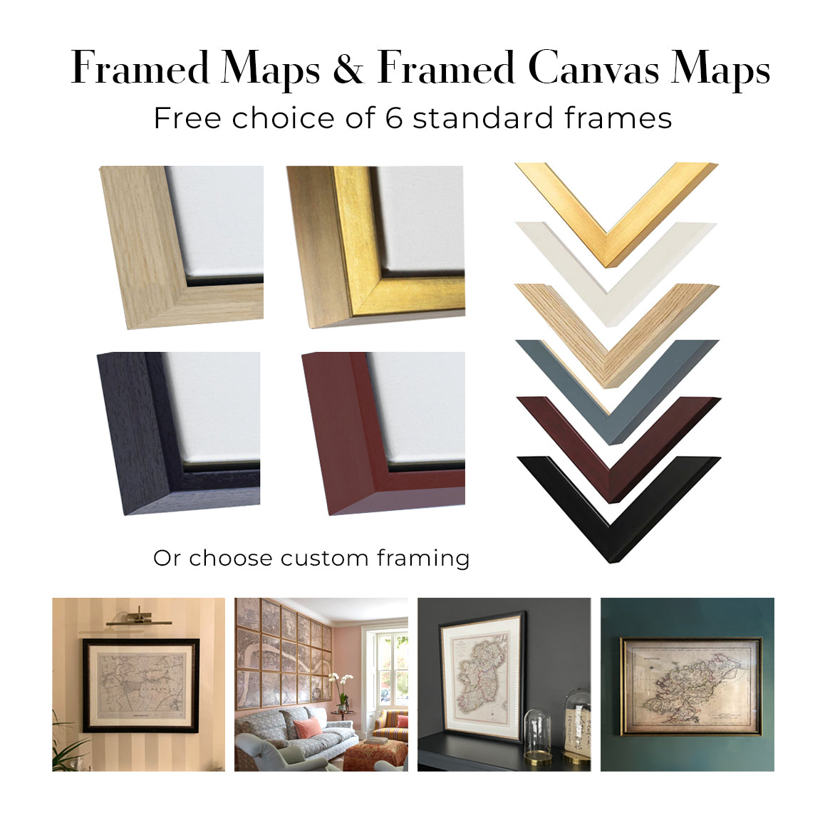
Six couleurs de cadre standard sont disponibles gratuitement (noir, marron foncé, gris foncé, chêne, blanc et or antique). Des encadrements et montages/matelassages personnalisés sont disponibles si vous recherchez autre chose.
La plupart des cartes, œuvres d'art et illustrations sont également disponibles sous forme de toile encadrée. Nous utilisons une toile en coton mate (non brillante), que nous tendons sur un cadre en bois de boîte provenant de sources durables, puis nous 'flottions' la pièce à l'intérieur d'un cadre en bois. Le résultat final est assez beau, et il n'y a pas de vitrage qui gêne.
Tous les cadres sont fournis "prêts à accrocher", avec soit une corde, soit des supports à l'arrière. Les très grands cadres auront des plaques de suspension lourdes et/ou une latte de montage. Si vous avez des questions, veuillez nous contacter.
Voir quelques exemples de mes cartes encadrées et de cartes en toile encadrées.
Alternativement, je peux également fournir de vieilles cartes et œuvres d'art sur toile, sur panneau en mousse, en coton et d'autres matériaux.
Si vous souhaitez encadrer votre carte ou œuvre d'art vous-même, veuillez lire d'abord mon guide des tailles.
Nous travaillons avec des architectes d’intérieur, des établissements hôteliers, des professionnels de l’immobilier, des bureaux et des acheteurs d’entreprise, pour des pièces individuelles comme pour des projets coordonnés de plus grande envergure.
Cette œuvre peut être adaptée à un mur, une pièce ou un projet spécifique, et notre atelier peut vous aider à coordonner les dimensions, le matériau et l’encadrement avant la production.
- Dimensions exactes, grand format et sur mesure
- Encadrement, montage et matériaux alternatifs sur mesure
- Pièces coordonnées pour plusieurs pièces ou emplacements
- Personnalisation de l’œuvre, pour ajuster la couleur et le style de la pièce
- Conseils de notre atelier sur l’œuvre et l’encadrement
- Production locale pour des projets dans le monde entier
Échangez avec notre équipe Trade & Projects au sujet de cette pièce
Chaque impression artistique restaurée commence par l’œuvre originale de l’artiste — jamais par un substitut généré par IA.
Notre atelier de Londres travaille à partir de documents source soigneusement sélectionnés dans des musées, bibliothèques, archives et collections privées. Nous restaurons les dommages liés à l’âge, les couleurs passées et les défauts de reproduction, tout en préservant la composition, les coups de pinceau, le trait, la texture et le caractère d’époque de l’artiste.
Nous n’utilisons pas d’IA générative pour redessiner, réinterpréter ou inventer l’œuvre. La restauration numérique est utilisée uniquement pour récupérer et reproduire l’œuvre originale aussi fidèlement que possible.
Une fois restaurée, l’œuvre maîtresse est préparée dans le format et la finition que vous avez choisis. Votre pièce est ensuite imprimée et, le cas échéant, encadrée à proximité de sa destination de livraison.
Nos impressions d’art giclée utilisent un papier mat d’archivage sans acide de 200 g/m² et des encres pigmentaires résistantes à la décoloration pour une finition riche, digne d’un musée. Les impressions d’art encadrées utilisent un acrylique optique cristallin et arrivent prêtes à être accrochées.
Des toiles encadrées et des éditions spécialisées sur papier coton-rag sont également disponibles. En savoir plus sur nos matériaux et finitions.
Nous restaurons et produisons des cartes et des tirages d’art depuis 1984, et nous garantissons chaque pièce.
Chaque commande est couverte par notre garantie de 10 ans et notre garantie de livraison sans dommage. Si votre pièce arrive endommagée, nous la remplacerons ou la referons gratuitement. Si quoi que ce soit d’autre ne vous donne pas entière satisfaction, contactez notre équipe d’atelier et nous y remédierons rapidement.
Consultez notre politique de retours et de remboursement pour plus de détails.


