


Antica mappa di Carmarthenshire di Lewis, 1844: Llanelli, Carmarthen, Tywi, Black Mountain, Castello di Kidwelly
L’offerta del Collezionista
Scegli due opere idonee e ricevi il 20% di sconto su entrambe. Scegline tre e quella al prezzo più basso è in omaggio, con un risparmio massimo del 33%.
Abbina liberamente mappe standard idonee e stampe d’arte fine art. Non è richiesto alcun codice; l’offerta viene applicata automaticamente al checkout.
Sono incluse le configurazioni standard su ordinazione. Sono esclusi formati su misura, design personalizzati e lavori su commissione.
Hai bisogno di consegne a indirizzi diversi? Contattaci prima di effettuare l’ordine.L’offerta del Collezionista
Scegli due opere idonee e ricevi il 20% di sconto su entrambe. Scegline tre e quella al prezzo più basso è in omaggio, con un risparmio massimo del 33%.
Abbina liberamente mappe standard idonee e stampe d’arte fine art. Non è richiesto alcun codice; l’offerta viene applicata automaticamente al checkout.
Sono incluse le configurazioni standard su ordinazione. Sono esclusi formati su misura, design personalizzati e lavori su commissione.
Hai bisogno di consegne a indirizzi diversi? Contattaci prima di effettuare l’ordine. Restaurato a Londra • Prodotto in the USA

Restaurata dalla mappa originale del 1844 e stampata in qualità museale. Leggi la storia dietro questa mappa
Choose your size
Choose your finish


(Maggiori informazioni)
Gift message & custom finish

If you want to add a gift message, or a finish (jigsaw, aluminium board, etc.) that is not available here, please request it in the "order note" when you check out.
Every order is custom made, so if you need the size adjusted slightly, or printed on an unusual material, just let us know. We've done thousands of custom orders over the years, so there's (almost) nothing we can't manage.
You can also contact us before you order, if you prefer!

- Prodotto localmente. Consegna sicura
- Nessun dazio o costo nascosto
- Serve aiuto? Chiamaci o messaggio su WhatsApp
Own a piece of history
8,000+ five-star reviews


Contea di Carmarthenshire, pubblicata da Samuel Lewis and Co. nel 1844 per l’Atlas to the Topographical Dictionaries of England and Wales, concentra...
Continua a leggereContea di Carmarthenshire, pubblicata da Samuel Lewis and Co. nel 1844 per l’Atlas to the Topographical Dictionaries of England and Wales, concentra una ricca contea gallese in un sapiente connubio di erudizione e arte. La nitidezza distintiva di Lewis guida lo sguardo dai confini amministrativi colorati alle sottili tratteggiature che danno vita a colline e valli. Un’elegante rosa dei venti orienta il nord verso l’angolo superiore destro, gentile promemoria che la prospettiva fa parte del mestiere del cartografo. Città e porti—Carmarthen, Llanelli, Llandeilo, Ammanford, Burry Port e il bilingue Cydweli/Kidwelly—entrano in dialogo con le strade, le ferrovie nascenti, i ponti e i punti di riferimento che li collegano. Il risultato è un panorama conciso del Galles di metà Ottocento: politicamente preciso, fisicamente evocativo e storicamente risonante.
I fiumi della contea sono i fili narrativi della carta. Il Tywi curva ampio e sicuro oltre Carmarthen verso il mare, raccogliendo il Cothi e altri affluenti; il Tâf scivola verso il suo estuario; i due Gwendraeth intrecciano le pianure basse presso Cydweli; il Loughor segna le marche orientali. Lewis accentua il rilievo con una meticolosa tratteggiatura, ombreggiando le creste frastagliate della Black Mountain sul fianco orientale della contea e i terrazzi d’altura che scandiscono una graduale discesa verso la baia di Carmarthen. I ponti punteggiano gli attraversamenti chiave—gesti ingegneristici che univano parrocchia a parrocchia—mentre i margini estuarini e le paludi salmastre annunciano le zone liminali in cui si intrecciano economie fluviali e marittime. In questo scenario, fattorie, villaggi, chiese e castelli si adagiano in un paesaggio modellato da lungo tempo da acqua e pietra.
Movimento e impresa animano il foglio. Le strade carrozzabili si irradiano dalla città capoluogo di Carmarthen verso Llandeilo e Llanelli, mentre i corridoi costieri collegano il nascente porto di Burry Port alle energie industriali del distretto di Llanelly. Lewis segnala le ferrovie in un momento formativo, quando le tranvie minerarie e le prime linee cominciavano a cucire miniere di carbone e cave ai moli, prefigurando la rivoluzione ferroviaria del South Wales che sarebbe presto seguita. I canali—soprattutto il Kidwelly and Llanelly Canal e i suoi canali alimentatori—tracciano percorsi deliberati attraverso le valli del Gwendraeth e del Llwchwr, emblematici di un’epoca che bilanciava forza animale e potenza idraulica. Insieme, binari, strade a pedaggio e vie d’acqua formano una pratica maglia per viaggio e commercio, mettendo in luce come carbone, rame e prodotti agricoli scorressero attraverso le città del Carmarthenshire e oltre, verso il mondo più ampio.
Per Lewis, l’amministrazione è l’ossatura indispensabile della cartografia. Il confine della contea è delineato con precisione rispetto alle contee vicine, mentre le suddivisioni interne sono articolate in velature diverse che distinguono distretti e parrocchie con intuitiva chiarezza. I riferimenti alle union—in particolare quelle centrate su Carmarthen, Llandilo e Llanelli—ancorano la carta al quadro della Poor Law post-1834, quando governo locale, assistenza e tenuta dei registri furono riorganizzati lungo linee nuove, spesso sovrapposte. Questo approccio stratificato chiarisce come giurisdizioni ecclesiastiche, civili e assistenziali si intersecassero nella vita quotidiana, dalla manutenzione di ponti e strade alla registrazione di nascite e matrimoni. La carta serve così non solo il viaggiatore e lo storico, ma anche il genealogista e il giurista, traducendo la burocrazia in colore e forma leggibili.
Il risultato di Samuel Lewis risiede nella sintesi. Celebrato compilatore di storie regionali, egli fuse le voci esaustive dei suoi Dizionari Topografici con mappe chiare, eleganti e discretamente erudite. Qui, i caratteri sono scelti con giudizio, i toponimi gallesi e inglesi convivono senza affollamento, e i luoghi emblematici—il castello di Carmarthen, la medievale potenza di Kidwelly, le romantiche alture nei pressi di Llandeilo—sono collocati in un contesto vivo anziché come semplice ornamento. La sua Carmarthenshire del 1844 invita a una passeggiata nel tempo: lungo sponde fluviali bordate da mulini, attraverso ponti che collegano mercato e brughiera, fino a città la cui fortuna sarebbe cresciuta con la ferrovia e il porto. Cattura una contea sospesa tra tradizione e trasformazione, resa con la calma sicurezza di un maestro topografo.
Cities and towns on this map
- Carmarthen (modern-day population: approx. 14,000)
- Llanelli (modern-day population: approx. 30,000)
- Ammanford (modern-day population: approx. 5,000)
- Llandeilo (modern-day population: approx. 4,000)
- Burry Port (modern-day population: approx. 5,500)
- Kidwelly (modern-day population: approx. 2,500)
Notable Features & Landmarks
- Administrative boundaries marked in various colors.
- Major towns and cities labeled within Carmarthenshire.
- Roads and railroads indicated for transportation reference.
- Various landmarks, including historic sites and natural features.
- Rivers and canals that contribute to the region's waterways.
- Detailed hachures representing undulating terrain.
- A compass rose for orientation.
- Reference to unions and their categorization in the context of the area.
Historical and design context
- Created By: Samuel Lewis in 1844
- Published By: Samuel Lewis and Co., in the Atlas to the Topographical Dictionaries of England and Wales
- Mapmaker Context: Samuel Lewis was recognized for his contributions to topographical literature and maps relating to Great Britain, providing valuable regional histories.
- Design/Style Context: The map is hand-colored, utilizing hachures to indicate relief and depth. North is oriented to the upper right, and a compass rose is included, enhancing navigational utility.
- Historical Significance: This antique map reflects 19th-century English cartography, showcasing both geographical layout and artistic skill, making it significant for historical and educational purposes.
Controlla attentamente le immagini per assicurarti che una città o località specifica sia mostrata su questa mappa. Puoi anche contattarci e chiederci di verificare la mappa per te.
Questa mappa sta benissimo in qualsiasi formato, ma consiglio sempre di scegliere una dimensione maggiore se hai spazio. In questo modo potrai distinguere facilmente tutti i dettagli.
Questa mappa è straordinaria fino a dimensioni pari a 50in (125cm). Se stai cercando una mappa più grande, contattaci.
Il modello nelle immagini dell'inserzione tiene in mano la versione 16x20in (40x50cm) di questa mappa.
La quinta immagine dell'inserzione mostra un esempio del mio servizio di personalizzazione delle mappe.
Se cerchi qualcosa di leggermente diverso, dai un'occhiata alla mia collezione delle migliori mappe antiche per vedere se qualcos'altro cattura il tuo interesse.
Per favore contattami per verificare se una determinata località, punto di interesse o elemento è mostrato su questa mappa.
Questo sarebbe un meraviglioso regalo di compleanno, Natale, Festa del Papà, regalo di commiato dal lavoro, anniversario o inaugurazione della casa per qualcuno proveniente dalle aree coperte da questa mappa.
Questa mappa è disponibile come stampa giclée su carta opaca da archivio priva di acidi, oppure può essere acquistata già incorniciata. La cornice è una bella e semplice cornice nera, adatta alla maggior parte degli stili d’arredo. Contattatemi se desiderate un colore o un materiale della cornice diverso. Le mie cornici sono dotate di vetro acrilico di qualità museale super-trasparente (perspex/acrylite), significativamente meno riflettente del vetro, più sicuro e che arriverà sempre in perfette condizioni.
This map is also available as a float framed canvas, sometimes known as a shadow gap framed canvas or canvas floater. The map is printed on artist's cotton canvas and then stretched over a handmade box frame. We then "float" the canvas inside a wooden frame, which is available in a range of colours (black, dark brown, oak, antique gold and white). This is a wonderful way to present a map without glazing in front. See some examples of float framed canvas maps and explore the differences between my different finishes.
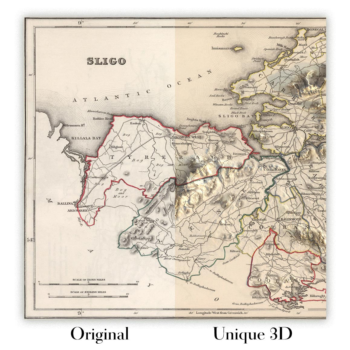
For something truly unique, this map is also available in "Unique 3D", our trademarked process that dramatically transforms the map so that it has a wonderful sense of depth. We combine the original map with detailed topography and elevation data, so that mountains and the terrain really "pop". For more info and examples of 3D maps, check my Unique 3D page.
Contea di Carmarthenshire, pubblicata da Samuel Lewis and Co. nel 1844 per l’Atlas to the Topographical Dictionaries of England and Wales, concentra una ricca contea gallese in un sapiente connubio di erudizione e arte. La nitidezza distintiva di Lewis guida lo sguardo dai confini amministrativi colorati alle sottili tratteggiature che danno vita a colline e valli. Un’elegante rosa dei venti orienta il nord verso l’angolo superiore destro, gentile promemoria che la prospettiva fa parte del mestiere del cartografo. Città e porti—Carmarthen, Llanelli, Llandeilo, Ammanford, Burry Port e il bilingue Cydweli/Kidwelly—entrano in dialogo con le strade, le ferrovie nascenti, i ponti e i punti di riferimento che li collegano. Il risultato è un panorama conciso del Galles di metà Ottocento: politicamente preciso, fisicamente evocativo e storicamente risonante.
I fiumi della contea sono i fili narrativi della carta. Il Tywi curva ampio e sicuro oltre Carmarthen verso il mare, raccogliendo il Cothi e altri affluenti; il Tâf scivola verso il suo estuario; i due Gwendraeth intrecciano le pianure basse presso Cydweli; il Loughor segna le marche orientali. Lewis accentua il rilievo con una meticolosa tratteggiatura, ombreggiando le creste frastagliate della Black Mountain sul fianco orientale della contea e i terrazzi d’altura che scandiscono una graduale discesa verso la baia di Carmarthen. I ponti punteggiano gli attraversamenti chiave—gesti ingegneristici che univano parrocchia a parrocchia—mentre i margini estuarini e le paludi salmastre annunciano le zone liminali in cui si intrecciano economie fluviali e marittime. In questo scenario, fattorie, villaggi, chiese e castelli si adagiano in un paesaggio modellato da lungo tempo da acqua e pietra.
Movimento e impresa animano il foglio. Le strade carrozzabili si irradiano dalla città capoluogo di Carmarthen verso Llandeilo e Llanelli, mentre i corridoi costieri collegano il nascente porto di Burry Port alle energie industriali del distretto di Llanelly. Lewis segnala le ferrovie in un momento formativo, quando le tranvie minerarie e le prime linee cominciavano a cucire miniere di carbone e cave ai moli, prefigurando la rivoluzione ferroviaria del South Wales che sarebbe presto seguita. I canali—soprattutto il Kidwelly and Llanelly Canal e i suoi canali alimentatori—tracciano percorsi deliberati attraverso le valli del Gwendraeth e del Llwchwr, emblematici di un’epoca che bilanciava forza animale e potenza idraulica. Insieme, binari, strade a pedaggio e vie d’acqua formano una pratica maglia per viaggio e commercio, mettendo in luce come carbone, rame e prodotti agricoli scorressero attraverso le città del Carmarthenshire e oltre, verso il mondo più ampio.
Per Lewis, l’amministrazione è l’ossatura indispensabile della cartografia. Il confine della contea è delineato con precisione rispetto alle contee vicine, mentre le suddivisioni interne sono articolate in velature diverse che distinguono distretti e parrocchie con intuitiva chiarezza. I riferimenti alle union—in particolare quelle centrate su Carmarthen, Llandilo e Llanelli—ancorano la carta al quadro della Poor Law post-1834, quando governo locale, assistenza e tenuta dei registri furono riorganizzati lungo linee nuove, spesso sovrapposte. Questo approccio stratificato chiarisce come giurisdizioni ecclesiastiche, civili e assistenziali si intersecassero nella vita quotidiana, dalla manutenzione di ponti e strade alla registrazione di nascite e matrimoni. La carta serve così non solo il viaggiatore e lo storico, ma anche il genealogista e il giurista, traducendo la burocrazia in colore e forma leggibili.
Il risultato di Samuel Lewis risiede nella sintesi. Celebrato compilatore di storie regionali, egli fuse le voci esaustive dei suoi Dizionari Topografici con mappe chiare, eleganti e discretamente erudite. Qui, i caratteri sono scelti con giudizio, i toponimi gallesi e inglesi convivono senza affollamento, e i luoghi emblematici—il castello di Carmarthen, la medievale potenza di Kidwelly, le romantiche alture nei pressi di Llandeilo—sono collocati in un contesto vivo anziché come semplice ornamento. La sua Carmarthenshire del 1844 invita a una passeggiata nel tempo: lungo sponde fluviali bordate da mulini, attraverso ponti che collegano mercato e brughiera, fino a città la cui fortuna sarebbe cresciuta con la ferrovia e il porto. Cattura una contea sospesa tra tradizione e trasformazione, resa con la calma sicurezza di un maestro topografo.
Cities and towns on this map
- Carmarthen (modern-day population: approx. 14,000)
- Llanelli (modern-day population: approx. 30,000)
- Ammanford (modern-day population: approx. 5,000)
- Llandeilo (modern-day population: approx. 4,000)
- Burry Port (modern-day population: approx. 5,500)
- Kidwelly (modern-day population: approx. 2,500)
Notable Features & Landmarks
- Administrative boundaries marked in various colors.
- Major towns and cities labeled within Carmarthenshire.
- Roads and railroads indicated for transportation reference.
- Various landmarks, including historic sites and natural features.
- Rivers and canals that contribute to the region's waterways.
- Detailed hachures representing undulating terrain.
- A compass rose for orientation.
- Reference to unions and their categorization in the context of the area.
Historical and design context
- Created By: Samuel Lewis in 1844
- Published By: Samuel Lewis and Co., in the Atlas to the Topographical Dictionaries of England and Wales
- Mapmaker Context: Samuel Lewis was recognized for his contributions to topographical literature and maps relating to Great Britain, providing valuable regional histories.
- Design/Style Context: The map is hand-colored, utilizing hachures to indicate relief and depth. North is oriented to the upper right, and a compass rose is included, enhancing navigational utility.
- Historical Significance: This antique map reflects 19th-century English cartography, showcasing both geographical layout and artistic skill, making it significant for historical and educational purposes.
Controlla attentamente le immagini per assicurarti che una città o località specifica sia mostrata su questa mappa. Puoi anche contattarci e chiederci di verificare la mappa per te.
Questa mappa sta benissimo in qualsiasi formato, ma consiglio sempre di scegliere una dimensione maggiore se hai spazio. In questo modo potrai distinguere facilmente tutti i dettagli.
Questa mappa è straordinaria fino a dimensioni pari a 50in (125cm). Se stai cercando una mappa più grande, contattaci.
Il modello nelle immagini dell'inserzione tiene in mano la versione 16x20in (40x50cm) di questa mappa.
La quinta immagine dell'inserzione mostra un esempio del mio servizio di personalizzazione delle mappe.
Se cerchi qualcosa di leggermente diverso, dai un'occhiata alla mia collezione delle migliori mappe antiche per vedere se qualcos'altro cattura il tuo interesse.
Per favore contattami per verificare se una determinata località, punto di interesse o elemento è mostrato su questa mappa.
Questo sarebbe un meraviglioso regalo di compleanno, Natale, Festa del Papà, regalo di commiato dal lavoro, anniversario o inaugurazione della casa per qualcuno proveniente dalle aree coperte da questa mappa.
Questa mappa è disponibile come stampa giclée su carta opaca da archivio priva di acidi, oppure può essere acquistata già incorniciata. La cornice è una bella e semplice cornice nera, adatta alla maggior parte degli stili d’arredo. Contattatemi se desiderate un colore o un materiale della cornice diverso. Le mie cornici sono dotate di vetro acrilico di qualità museale super-trasparente (perspex/acrylite), significativamente meno riflettente del vetro, più sicuro e che arriverà sempre in perfette condizioni.
This map is also available as a float framed canvas, sometimes known as a shadow gap framed canvas or canvas floater. The map is printed on artist's cotton canvas and then stretched over a handmade box frame. We then "float" the canvas inside a wooden frame, which is available in a range of colours (black, dark brown, oak, antique gold and white). This is a wonderful way to present a map without glazing in front. See some examples of float framed canvas maps and explore the differences between my different finishes.
For something truly unique, this map is also available in "Unique 3D", our trademarked process that dramatically transforms the map so that it has a wonderful sense of depth. We combine the original map with detailed topography and elevation data, so that mountains and the terrain really "pop". For more info and examples of 3D maps, check my Unique 3D page.
Many of our maps and art prints are chosen as thoughtful gifts for homes, offices, studies and meaningful places.
Choose a framed option for the easiest ready-to-hang gift, or choose an unframed print if the recipient may prefer to select their own frame.
We make orders locally in 23 countries around the world, so gifts can often be produced close to the recipient. This helps them arrive faster, travel more safely, and avoid customs or import duty surprises.
- We can deliver directly to the recipient
- Framed pieces arrive ready to hang
- Unframed prints are carefully packed in a strong protective tube
- Almost every order is made locally, for faster, safer gifting
- 90-day returns give the recipient time to decide
If you are not sure what to choose, please contact us. We can help you pick the right map, size, finish or delivery option.
Most orders are made locally and delivered in around 2–3 working days, depending on the product, size and destination.
We print and frame maps and artwork in 23 countries around the world, so your order is usually made close to you or your recipient. That means faster delivery, less time in transit, and no customs or import duty surprises.
Personalised and customised pieces usually take an extra 1–2 working days, because we prepare your design and send it to you for approval before printing.
Very large framed orders can take a little longer, as they need extra care in production and delivery.
Every order is carefully packaged: unframed prints are sent in a strong protective tube, while framed pieces are securely packed with protective materials around the frame.
If you need your order by a particular date, please contact us before ordering. We’ll check the best production route and delivery option for your location.
Express delivery is available at checkout for most countries. Next-day delivery is available in the UK, US, Singapore and the UAE.
Your order is covered by our 90-day returns policy and 10-year guarantee.
Our standard frame is a gallery-style black ash hardwood frame, with a simple, modern look. It is approximately 20mm (0.8in) wide. You can also view some lovely customer photos of framed maps and art.
We use super-clear acrylic glazing, also known as Perspex or Acrylite, instead of traditional glass. It is lighter, safer, and has lower reflectivity, giving the artwork a clearer, cleaner appearance.
Six standard frame colours are available at no extra cost: black, dark brown, dark grey, oak, white, and antique gold. Custom framing and mounting/matting is also available for customers looking for something more specific.
Most maps, art prints, and illustrations are also available as a framed canvas. We use matte cotton canvas, stretch it over a sustainably sourced wooden box frame, and then float the piece within a wooden outer frame. The finished result is beautifully presented, with no glazing between you and the artwork.
All frames are supplied ready to hang, with either string or brackets fitted to the back. Very large frames will include heavy-duty hanging plates and/or a mounting baton. If you have any questions, please get in touch.
We can also supply old maps and artwork on canvas, foam board, cotton rag, and other materials.
If you would prefer to frame your map or artwork yourself, please read our size guide before ordering.
Every Unique Maps piece begins with an authentic cartographic source or an original design from our London studio.
For our historic maps, we source rare originals from libraries, archives, auction houses and private collections around the world. We carefully restore each map for print—repairing age-related damage, balancing colour and improving clarity while preserving its original detail, texture and character.
Once restored, the map is prepared for your chosen size and finish. Your piece is then printed and, where selected, framed close to its delivery destination.
Our map prints use acid-free 200gsm archival matte paper and fade-resistant pigment inks, creating a rich, non-glossy finish designed to last. Framed maps use crystal-clear optical acrylic and arrive ready to hang.
Canvas, cotton-rag and other specialist presentations are also available. Learn more about our materials and finishes.
Personalising your map
You can add a short title or dedication, mark one meaningful place, or request one considered visual detail. For personalised designs, we send a proof before printing and you can request changes before approval.
For more complex bespoke commissions, contact our design team.
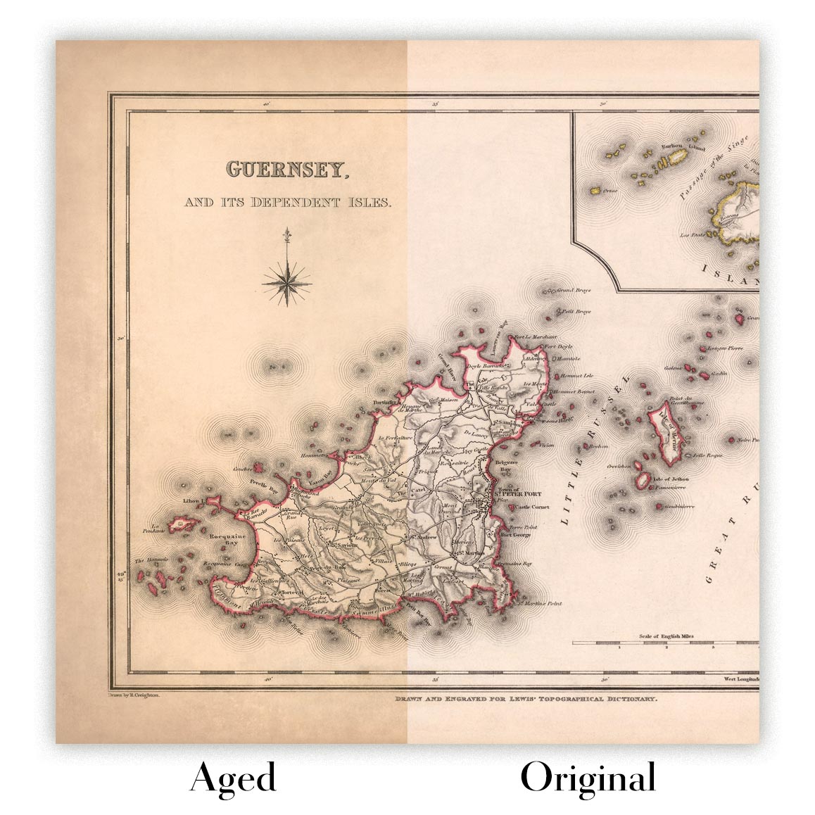
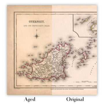
Original or Aged
Choose Original for true-to-source colour, or Aged for a warmer, richer antique character created with our specialist ageing process. See examples of our Aged maps.
Se non sei soddisfatto del tuo ordine per qualsiasi motivo, contattami per un rimborso senza problemi. Si prega di consultare la nostra politica di reso e rimborso per ulteriori informazioni.
Sono molto sicuro che ti piacerà la tua mappa restaurata o la stampa d'arte. Lo faccio dal 1984. Sono un venditore Etsy a 5 stelle. Ho venduto decine di migliaia di mappe e stampe d'arte e ho oltre 5.000 recensioni reali a 5 stelle.
Utilizzo un processo unico per restaurare mappe e opere d'arte che richiede molto tempo e lavoro. Trovare le mappe e le illustrazioni originali può richiedere mesi. Utilizzo tecnologia all'avanguardia e incredibilmente costosa per scannerizzare e restaurarle. Di conseguenza, garantisco che le mie mappe e stampe d'arte siano superiori alle altre - ecco perché posso offrire un rimborso senza problemi.
Quasi tutte le mie mappe e stampe d'arte sembrano fantastiche a grandi dimensioni (200 cm, 6,5 piedi+) e posso anche incorniciarle e consegnarle a te, tramite un corriere speciale per oggetti di grandi dimensioni. Contattami per discutere delle tue esigenze specifiche.
Or try searching for something!


